

भारत का भूगोल– सामान्य जानकारी Geography of India - General Information
नामकरण : हमारे देश भारत का नाम दुष्यंत और शकुंतला के पुत्र 'भरत' के नाम पर रखा गया था। वे ऋग्वैदिक काल के प्रमुख जन थे। उनका उल्लेख वायु पुराण में मिलता है। भारत को 'आर्यावर्त' के नाम से भी जाना जाता है। इसे यह नाम इसीलिए प्राप्त हुआ क्योंकि यह प्राचीन काल में 'आर्यों' का निवास स्थल था। भारत को 'हिंद' या 'हिंदुस्तान' कहकर भी संबोधित किया जाता है। इसे यह नाम मध्यकालीन इतिहास लेखकों (फारसी, अरबी आदि) ने दिया था। यूनानी लेखकों ने भारत को 'इंडिया' कहा है। 'इंडिया' शब्द की उत्पत्ति यूनानी भाषा के शब्द 'इंडोई' से हुई है।
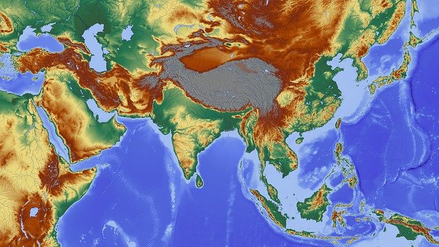
आकार एवं विस्तार: भारत की आकृति वर्तमान में लगभग चतुष्कोणीय है। भारतवर्ष का कुल क्षेत्रफल 32,87,263 वर्ग किलोमीटर है। भारत का कुल क्षेत्रफल विश्व के कुल क्षेत्रफल का 2.4% भाग है। क्षेत्रफल की दृष्टि से भारत का विश्व में सातवाँ तथा जनसंख्या की दृष्टि से दूसरा स्थान है। भारत का उत्तर से दक्षिण तक विस्तार 3,214 किलोमीटर है। तथा पूर्व से पश्चिम तक विस्तार 2,933 किलोमीटर है। भारत की कुल तटीय रेखा की लंबाई 7,517 किलोमीटर है। इसमें अंडमान एवं निकोबार द्वीप समूह तथा लक्षद्वीप समूह को भी शामिल किया गया है। भारत की कुल स्थलीय सीमा की लंबाई 15,200 किलोमीटर है। विभिन्न भौगोलिक स्रोतों के अनुसार भारत का अक्षांशीय एवं देशांतरीय विस्तार लगभग 30° माना जाता है। भारत उत्तर में केंद्र शासित प्रदेश 'लद्दाख' से लेकर दक्षिण में तमिलनाडु के 'कन्याकुमारी' तक विस्तृत है तथा यह पूर्व में अरुणाचल प्रदेश से लेकर पश्चिम में गुजरात के 'कच्छ' जिले तक फैला हुआ है। भारत की स्थलीय सीमाओं में वलित पर्वत स्थित हैं। भारत के दक्षिण में प्रायद्वीपीय क्षेत्र है, जो उत्तर में चौड़ा है एवं दक्षिण में 22° उत्तरी अक्षांश से सँकरा होता गया है। भारत के पूर्व में बंगाल की खाड़ी स्थित है जहां पर अंडमान एवं निकोबार द्वीप समूह है। तथा पश्चिम में अरब सागर है जिसमें लक्ष्यद्वीप स्थित है। भारत के दक्षिण में हिंद महासागर है। हिंद महासागर का नाम भारत के ही नाम 'हिंदुस्तान' पर रखा गया है।
भौगोलिक स्थिति : भारत एशिया महाद्वीप में स्थित है तथा यह पृथ्वी के उत्तर पूर्वी गोलार्ध में स्थित है। भारत का विस्तार 8°4` मिनट उत्तरी अक्षांश से 37°6` उत्तरी अक्षांश तथा 68°7`पूर्वी देशांतर से 97°25` पूर्वी देशांतर तक है। कर्क रेखा 23°30` उत्तरी अक्षांश से गुजरती है। यह भारत को लगभग दो बराबर भागों में विभक्त करती है। यह रेखा भारत के 8 राज्यों से होकर गुजरती है।
भूगर्भिक संरचना : भारतीय भूगर्भिक संरचना का विकास पैंजिया महाद्वीप के विभाजन से प्रारंभ होता है। पैंजिया महाद्वीप दो भागों में विभाजित हुआ था। जिसके दो भाग अंगारा लैंड एवं गोंडवाना लैंड थे भारत का विकास गोंडवाना लैंड के विभाजन के बाद उसके एक भाग का उत्तर की ओर प्रवाह होने के कारण हुआ। भारत की प्रमुख संरचनाएं प्री-कैंब्रियन आर्कियन संरचना, धारवाड़, कुडप्पा, विंध्यन है।
भारत के राज्य एवं केंद्र शासित प्रदेश : भारत में कुल 28 राज्य एवं 8 केंद्र शासित प्रदेश हैं। इन्हे मुख्य रूप से छह भागों में विभाजित किया गया है-
1. उत्तरी क्षेत्र- जम्मू कश्मीर, लद्दाख, हिमाचल प्रदेश, पंजाब, दिल्ली, हरियाणा, राजस्थान, चंडीगढ़
2. पूर्वी क्षेत्र- ओडिशा, पश्चिम बंगाल, झारखंड, बिहार
3. पश्चिमी क्षेत्र- दमन और दीव तथा दादर और नगर हवेली, महाराष्ट्र, गोवा, गुजरात
4. मध्यवर्ती क्षेत्र- उत्तर प्रदेश, उत्तराखंड, मध्य प्रदेश, छत्तीसगढ़
5. दक्षिणी क्षेत्र- तमिलनाडु, आंध्र प्रदेश, कर्नाटक, केरल, तेलंगाना, पुदुचेरी, अंडमान निकोबार द्वीप समूह, लक्षद्वीप
6. पूर्वोत्तर क्षेत्र- मेघालय, त्रिपुरा, मिजोरम, मणिपुर, नागालैंड, अरुणाचल प्रदेश, असम, सिक्किम उत्तर पूर्व के सात राज्यों मेघालय, मिजोरम, मणिपुर, त्रिपुरा, नागालैंड, अरुणाचल प्रदेश और असम को भारत की 'सात बहनों' के नाम से जाना जाता है। क्षेत्रफल की दृष्टि से भारत का सबसे बड़ा राज्य 'राजस्थान' है तथा सबसे छोटा राज्य 'गोवा' है। जनसंख्या की दृष्टि से भारत का सबसे बड़ा राज्य 'उत्तर प्रदेश' है तथा सबसे छोटा राज्य 'सिक्किम' है। क्षेत्रफल की दृष्टि से सबसे बड़ा केंद्र शासित प्रदेश 'लद्दाख' है तथा सबसे छोटा 'लक्षद्वीप' है। जनसंख्या की दृष्टि से सबसे बड़ा केंद्र शासित प्रदेश 'दिल्ली' है तथा सबसे छोटा 'लक्षद्वीप' है। दमन और दीव के बीच खंभात की खाड़ी अवस्थित है। भारत के 9 राज्यों और 4 केंद्र शासित प्रदेश समुद्र किनारे स्थित है जिसमें से गुजरात की समुद्री तट रेखा सबसे लंबी तथा गोवा की समुद्री तट रेखा सबसे छोटी है। 19 राज्य एवं 4 केंद्र शासित प्रदेश स्थल रुद्ध हैं।
समुद्री तट रेखा वाले राज्य- गुजरात, गोवा, कर्नाटक, महाराष्ट्र, केरल, आंध्र प्रदेश, पश्चिम बंगाल, तमिलनाडु, उड़ीसा।
केंद्र शासित प्रदेश- पुडुचेरी, अंडमान निकोबार द्वीप समूह, लक्षद्वीप, दमन और दीव तथा दादरा और नगर हवेली।
भारत के राज्यों की राजधानी :
1. मेघालय- शिलांग
2. त्रिपुरा- अगरतला
3. मिजोरम- आइजोल
4. मणिपुर- इंफाल
5. नागालैंड- कोहिमा
6. अरुणाचल प्रदेश- इटानगर
7. असम- दिसपुर
8. सिक्किम- गंगटोक
9. पश्चिम बंगाल- कोलकाता
10. गोवा- पणजी
11. तेलंगाना- हैदराबाद
12. तमिलनाडु- चेन्नई
13. कर्नाटक- बेंगलुरु
14. केरल- तिरुवनंतपुरम
15. आंध्र प्रदेश- अमरावती [तीन राजधानियां प्रस्तावित अमरावती (विधायी), कुर्नूल (न्यायिक) और विशाखापत्तनम (कार्यकारी)]
16. महाराष्ट्र- मुंबई
17. झारखंड- राँची
18. उड़ीसा- भुनेश्वर
19. बिहार- पटना
20. गुजरात- गांधीनगर
21. मध्य प्रदेश- भोपाल
22. छत्तीसगढ़- रायपुर
23. राजस्थान- जयपुर
24. उत्तराखंड- देहरादून (सर्दियों में), गैरसैंण (ग्रीष्म काल में)
25. उत्तर प्रदेश- लखनऊ
26. पंजाब- चंडीगढ़
27. हरियाणा- चंडीगढ़
28. हिमाचल प्रदेश- शिमला (ग्रीष्म काल में) धर्मशाला (सर्दियों में)
केंद्र शासित प्रदेशों की राजधानी :
1. अंडमान एवं निकोबार द्वीप समूह- पोर्ट ब्लेयर
2. लक्षद्वीप- कवारत्ती
3. राष्ट्रीय राजधानी क्षेत्र दिल्ली- नई दिल्ली
4. दमन एवं दीव तथा दादरा और नगर हवेली-दमन
5. पुडुचेरी- पुडुचेरी
6. चंडीगढ़- चंडीगढ़
7. जम्मू कश्मीर- श्रीनगर (ग्रीष्म काल में), जम्मू (सर्दियों में)
8. लद्दाख- लेह
भारत के पड़ोसी देश : भारत के 16 राज्य और 2 केंद्र शासित प्रदेशों की सीमाएं विदेशों से लगती हैं। भारत की स्थलीय सीमा है 7 देशों से लगी हुई है। ये देश हैं- उत्तर में चीन, नेपाल और भूटान, उत्तर- पश्चिम में पाकिस्तान और अफगानिस्तान, पूर्व में म्यांमार और बांग्लादेश। दक्षिण दिशा में दो द्वीपीय देश भारत के पड़ोसी हैं। ये हैं- श्रीलंका और मालदीव। भारत, श्रीलंका, पाकिस्तान, भूटान, नेपाल, बांग्लादेश और मालदीव को मिलाकर भारतीय उपमहाद्वीप का निर्माण होता है।
पड़ोसी देशों से संबद्ध भारतीय राज्य एवं केंद्र शासित प्रदेश-
1. अफगानिस्तान- लद्दाख
2. भूटान- अरुणाचल प्रदेश, पश्चिम बंगाल, असम, सिक्किम
3. म्यांमार- नागालैंड, मणिपुर, अरूणाचल प्रदेश, मिजोरम।
4. नेपाल- उत्तर प्रदेश, उत्तराखंड, पश्चिम बंगाल, बिहार, सिक्किम
5. पाकिस्तान- पंजाब, राजस्थान, गुजरात, जम्मू कश्मीर, लद्दाख
6. चीन- हिमाचल प्रदेश, उत्तराखंड, सिक्किम, अरुणाचल प्रदेश, लद्दाख
7. बांग्लादेश- मिजोरम, त्रिपुरा, असम, मेघालय, पश्चिम बंगाल।
Nomenclature: Our country India was named after Dushyant and Shakuntala's son 'Bharat' . He was a prominent figure of the Rigvedic period. He is mentioned in the Vayu Purana. India is also known as 'Aryavarta' . It received this name because it was the abode of 'Aryans' in ancient times. India is also referred to as 'Hind' or 'Hindustan' . It was given this name by medieval history writers (Persian, Arabic etc.). Greek writers call India 'India' . The word 'India' is derived from the Greek word 'indoi' .
Size and extent: The shape of India is currently approximately quadrangular . The total area of India is 32,87,263 sq km . India's total area is 2.4% of the total area of the world. India is seventh in terms of area and second in terms of population. India's expansion from north to south is 3,214 kilometers . And the extension from east to west is 2,933 km . The total coastline length of India is 7,517 km . Andaman and Nicobar Islands and Lakshadweep group are also included in this. The total terrestrial boundary length of India is 15,200 km . The latitudinal and longitudinal expansion of India is considered to be 30 ° according to various geographical sources. India extends from the Union Territory 'Ladakh' in the North to the 'Kanyakumari' of Tamil Nadu in the South and from Arunachal Pradesh in the East. To the west extends to the 'Kutch' district of Gujarat. The Valt Mountains are located on the terrestrial boundaries of India. There is a peninsular region in the south of India, which is wide in the north and is narrowed by 22 ° northern latitude in the south. The Bay of Bengal is located in the east of India, where the Andaman and Nicobar Islands are. And to the west is the Arabian Sea in which Lakshadweep is located. To the south of India is the Indian Ocean . The Indian Ocean is named after India itself 'Hindustan' .
Geographical location: India is located in the continent of Asia and it is located in the north eastern hemisphere of the Earth. Expansion of India 8 ° 4` minutes North latitude to 37 ° 6` North latitude and 68 ° 7` East longitude to 97 ° 25` East longitude . Cancer line passes through 23 ° 30` northern latitude. It divides India into about two equal parts. This line passes through 8 states of India.
Geological structure: Development of Indian geological structure begins with the partition of Pangea continent . The Pangea continent was divided into two parts. Two parts of which were Angara Land and Gondwana Land , India developed after the Gondwana Land split due to its northward flow. The major structures of India are the Pre-Cambrian Archaean structure, Dharwad, Kudappa, Vindhyan.
States and Union Territories of India: There are a total of 28 States and 8 Union Territories in India. They are mainly divided into six parts-
1. Northern Region - Jammu Kashmir, Ladakh, Himachal Pradesh, Punjab, Delhi, Haryana, Rajasthan, Chandigarh
2. Eastern Region - Odisha, West Bengal, Jharkhand, Bihar
3. Western Region - Daman & Diu and Dadar & Nagar Haveli, Maharashtra, Goa, Gujarat
4. Intermediate region - Uttar Pradesh, Uttarakhand, Madhya Pradesh, Chhattisgarh
5. Southern Region - Tamil Nadu, Andhra Pradesh, Karnataka, Kerala, Telangana, Puducherry, Andaman and Nicobar Islands, Lakshadweep
6. North East Region - Meghalaya, Tripura, Mizoram, Manipur, Nagaland, Arunachal Pradesh, Assam, Sikkim The seven states of North East, Meghalaya, Mizoram, Manipur, Tripura, Nagaland, Arunachal Pradesh and Assam are known as the 'Seven Sisters' of India. The largest state of India in terms of area is 'Rajasthan' and the smallest state is 'Goa' . India's largest state by population is 'Uttar Pradesh' and the smallest state is 'Sikkim' . The largest union territory in terms of area is 'Ladakh' and the smallest is 'Lakshadweep' . The largest union territory in terms of population is 'Delhi' and the smallest is 'Lakshadweep' . The Gulf of Khambhat is situated between Daman and Diu. 9 states and 4 union territories of India are located along the coast, out of which the coastline of Gujarat is the longest and the coastline of Goa is the shortest. 19 states and 4 union territory sites are locked.
States along the coastline - Gujarat, Goa, Karnataka, Maharashtra, Kerala, Andhra Pradesh, West Bengal, Tamil Nadu, Orissa.
Union Territory - Puducherry, Andaman and Nicobar Islands, Lakshadweep, Daman and Diu and Dadra and Nagar Haveli.
Capital of the states of India:
1. Meghalaya - Shillong
2. Tripura - Agartala
3. Mizoram - Aizawl
4. Manipur - Imphal
5. Nagaland - Kohima
6. Arunachal Pradesh - Itanagar
7. Assam- Dispur
8. Sikkim - Gangtok
9. West Bengal - Kolkata
10. Goa - Panaji
11. Telangana - Hyderabad
12. Tamil Nadu- Chennai
13. Karnataka - Bengaluru
14. Kerala - Thiruvananthapuram
15. Andhra Pradesh- Amravati [Three capitals proposed Amaravati (legislative), Kurnool (judicial) and Visakhapatnam (executive)]
16. Maharashtra - Mumbai
17. Jharkhand - Ranchi
18. Orissa - Bhuneshwar
19. Bihar- Patna
20. Gujarat - Gandhinagar
21. Madhya Pradesh - Bhopal
22. Chhattisgarh - Raipur
23. Rajasthan- Jaipur
24. Uttarakhand - Dehradun (in winter), Garasain (in summer)
25. Uttar Pradesh - Lucknow
26. Punjab- Chandigarh
27. Haryana- Chandigarh
28. Himachal Pradesh - Shimla (in summer) Dharamshala (in winter)
Capital of Union Territories:
1. Andaman and Nicobar Islands - Port Blair
2. Lakshadweep - Kavaratti
3. National Capital Territory of Delhi - New Delhi
4. Daman and Diu and Dadra and Nagar Haveli-Daman
5. Puducherry - Puducherry
6. Chandigarh- Chandigarh
7. Jammu Kashmir - Srinagar (in summer), Jammu (in winter)
8. Ladakh- Leh
India's neighboring country: 16 states and 2 union territories of India are bordered by foreign countries. India has a terrestrial border with 7 countries. These countries are- China, Nepal and Bhutan to the north, Pakistan and Afghanistan to the north-west, Myanmar and Bangladesh to the east. The two island countries in the south are India's neighbors. These are Sri Lanka and Maldives. India, Sri Lanka, Pakistan, Bhutan, Nepal, Bangladesh and Maldives together form the Indian subcontinent.
Indian States and Union Territories affiliated to neighboring countries -
1. Afghanistan - Ladakh
2. Bhutan - Arunachal Pradesh, West Bengal, Assam, Sikkim
3. Myanmar - Nagaland, Manipur, Arunachal Pradesh, Mizoram.
4. Nepal - Uttar Pradesh, Uttarakhand, West Bengal, Bihar, Sikkim
5. Pakistan- Punjab, Rajasthan, Gujarat, Jammu Kashmir, Ladakh
6. China- Himachal Pradesh, Uttarakhand, Sikkim, Arunachal Pradesh, Ladakh
7. Bangladesh - Mizoram, Tripura, Assam, Meghalaya, West Bengal.
RF competition
INFOSRF.COM
संबंधित जानकारी नीचे देखें।
(Watch related information below) 👇🏻

आशा है, उपरोक्त जानकारी उपयोगी एवं महत्वपूर्ण होगी।
(I hope the above information will be useful and important. )
Thank you.
लेखक
(Writer)
infosrf.com
पाठकों की टिप्पणियाॅं (0)
You may also like
यूरोप महाद्वीप के प्रमुख देश एवं उनकी राजधानियाँ | Europe's Main Countries And Their Capitals
यहाँ यूरोप महाद्वीप के प्रमुख देश एवं उनकी राजधानियाँ दी गई हैं। Europe's Main Countries And Their Capitals given here.
Read more
जर्मनी (यूरोप) की भौगोलिक एवं राजनीतिक विशेषताएँ | Geographical And Political Features Of Germany (Europe)
जर्मनी यूरोप महाद्वीप के महत्वपूर्ण देशों में से एक है। इसके उत्तर-पश्चिम में उत्तर सागर स्थित है। जर्मनी के उत्तर-पूर्व में बाल्टिक सागर स्थित है।
Read more.jpg)
फ्रांस (यूरोप) की भौगोलिक एवं राजनीतिक विशेषताएँ | Geographical And Political Features Of France (Europe)
फ्रांस क्षेत्रफल की दृष्टि से यूरोप महाद्वीप का दूसरा सबसे बड़ा देश है। यूरोप महाद्वीप का सबसे बड़ा देश रूस है।
Read more