


भारत का भौगोलिक खण्ड - महान हिमालय
Geographical Segment of India - Great Himalaya
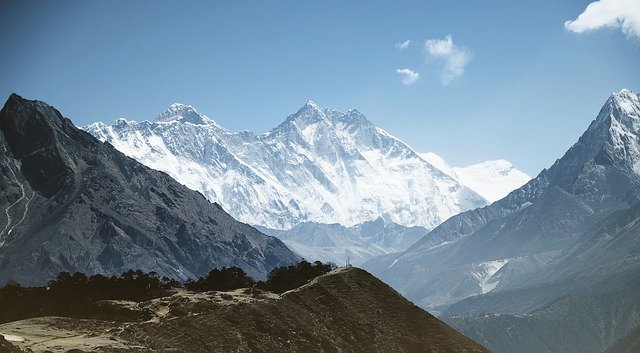
'हिमालय' भारतीय भू-आकृतिक संरचना का एक अभिन्न अंग है। यह उत्तर-पश्चिम में जम्मू-कश्मीर से लेकर पूर्व में अरुणाचल प्रदेश तक फैला हुआ है। इसकी लंबाई लगभग 2,500 किलोमीटर है। इसकी रचना 'टर्टियरी काल' के 'अल्पाइन भूसंचलन' के कारण हुई है। हिमालय पश्चिम में 400 किलोमीटर चौड़ा एवं पूर्व में 160 किलोमीटर चौड़ा है। यह पश्चिम में पूर्व की अपेक्षा अधिक चौड़ा है। इसका प्रमुख कारण अभिसारी सीमांत पर दबाव बल का अधिक होना है। पूर्व में दबाव बल अधिक होने के कारण पूर्व में स्थित पर्वतीय क्षेत्र पश्चिम की अपेक्षा अधिक ऊंचे हैं। इसी कारण 'माउंट एवरेस्ट' तथा 'कंचनजंगा' जैसी ऊंची पर्वत चोटियां पूर्वी हिमालय में स्थित है हिमालय पर्वत श्रेणियां भारत की ओर उत्तल तथा तिब्बत की और अवतल है।
'Himalaya' is an integral part of the Indian geomorphic structure. It extends from Jammu and Kashmir in the northwest to Arunachal Pradesh in the east. Its length is approximately 2,500 km . It is formed by 'Alpine Landscape' of 'Tertiary Period' . The Himalayas are 400 kilometers wide in the west and 160 kilometers wide in the east. It is wider in the west than in the east. The main reason for this is the high pressure force on the convergent frontier. Due to the high pressure force in the east, the mountainous regions in the east are higher than in the west. That is why the high mountain peaks like 'Mount Everest' and 'Kanchenjunga' are located in the eastern Himalayas, the Himalayan ranges are convex towards India and further concave of Tibet.
हिमालय की उत्पत्ति (Origin of Himalayas) :–
हिमालय की उत्पत्ति भारतीय प्लेट एवं यूरेशियन प्लेट की आपस में टकराने के कारण हुई है। इन दोनों प्लेटों के बीच स्थित 'टेथिस सागर' के अवसादो में वलन पड़ने के कारण हिमालय की उत्पन्न हुआ।
The Himalayas originated due to the collision of the Indian Plate and the Eurasian Plate . The Himalayas formed due to the folding of the 'Tethys Sea' sediments located between these two plates. हिमालय पर्वत उत्तर से दक्षिण की ओर फैला हुआ है। इसे इस आधार पर पांच भागों में विभाजित किया जा सकता है :–
1. ट्रांस हिमालय
2. वृहद् या आंतरिक हिमालय
3. लघु या मध्य हिमालय
4. शिवालिक बाह्य हिमालय
5. उत्तर-पूर्वी हिमालय
The Himalayan mountain ranges from north to south. It can be divided into five parts on this basis: -
1. Trans Himalaya
2. Large or Inner Himalaya
3. Short or Middle Himalaya
4. Shivalik Outer Himalaya
5. North-Eastern Himalaya
1. ट्रांस/परा हिमालय :– यह वृहद हिमालय से उत्तर दिशा में स्थित है। इसे 'तिब्बतियन हिमालय' भी कहा जाता है क्योंकि इसका अधिकांश भाग 'तिब्बत' में स्थित है। इस हिमालय के अंतर्गत कैलाश, लद्दाख, जास्कर और काराकोरम जैसी पर्वत श्रेणियां आती है। इस भाग में वनस्पतियां नहीं पाई जाती।
1. Trans / Para Himalayas: - It is located in the north direction from the Great Himalayas. It is also known as 'Tibetan Himalaya' because most of it is located in 'Tibet' . This Himalayan mountain ranges include Kailash, Ladakh, Zaskar and Karakoram . Flora is not found in this part.
ट्रांस हिमालय का निर्माण हिमालय से भी पहले हो चुका था। विश्व की दूसरी सबसे ऊंची चोटी और भारत की सबसे ऊंची चोटी 'गॉडविन ऑस्टिन' ट्रांस हिमालय में ही स्थित है। यह चोटी काराकोरम पर्वत श्रेणी में स्थित है। 'राकापोशी' चोटी भी यहाँ पर स्थित है। यह विश्व की सबसे अधिक तीव्र ढाल वाली चोटी है। काराकोरम श्रेणी पश्चिम की ओर 'पामीर गाँठ' तथा पूर्व की और 'कैलाश श्रेणी' तक फैली हुई है। इस श्रेणी में विभिन्न ग्लेशियर स्थित है। उदाहरण- विश्व प्रसिद्ध सियाचिन, बियाफो, हिस्पर ग्लेशियर और बाल्टोरो इत्यादि।
The Trans Himalayas were formed even before the Himalayas. The world's second highest peak and India's highest peak 'Godwin Austin' is located in the Trans Himalayas. This peak is located in the Karakoram mountain range . 'Rakaposhi' peak is also located here. It is the highest steep slope in the world. The Karakoram range extends westward to 'Pamir Knot' and to the east and 'Kailash Range' . Various glaciers are located in this range. Examples- World famous Siachen, Biafo, Hispar Glacier and Baltoro etc.
काराकोरम श्रेणी को 'उच्च एशिया की रीढ़' भी कहा जाता है। ट्रांस हिमालय, वृहद हिमालय से आई टी एस जेड द्वारा अलग होता है। ट्रांस हिमालय की जास्कर और लद्दाख श्रेणी के बीच से होकर 'सिंधु नदी' बहती है और यह लद्दाख श्रेणी को 'बूंजी' नामक स्थान पर काटकर 'भारत की सबसे गहरी गार्ज' का निर्माण करती है। यह गार्ज 5,200 मीटर गहरी है।
The Karakoram category is also known as 'the backbone of higher Asia' . The Trans Himalayas are separated from the Great Himalayas by the ITS Z . The 'Indus River' flows between the Zaskar and Ladakh Range of the Trans Himalaya and it flows to the Ladakh Range. Cut to a place called 'Booji' and make 'India's deepest guard' . This guard is 5,200 m deep.
2. वृहद् या महान हिमालय :– इसे 'बर्फीला हिमालय' या 'हिमाद्रि' कहा जाता है क्योंकि यह सदा बर्फ से ढका रहता है। इस हिमालय का विस्तार पश्चिम में सिंधु नदी के गार्ज से लेकर अरुणाचल प्रदेश में नामचा बरवा पर्वत तक है।
2. Great or Great Himalayas: - It is called 'Icy Himalaya' or 'Himadri' because it is always covered with snow. The Himalayas extend from the Guards of the Indus River in the west to the Namcha Barwa Mountains in Arunachal Pradesh.
यह हिमालय सबसे प्राचीनतम है। इसकी रचना समानांतर वलय श्रेणियों से हुई है। महान हिमालय, लघु हिमालय से 'एन सी टी' द्वारा अलग होता है। विश्व की सर्वाधिक ऊंची चोटियाँ इसी हिमालय पर स्थित है। इसकी औसत ऊंचाई लगभग 6,100 मीटर है। 'माउंट एवरेस्ट' या 'सागरमाथा' इसकी सबसे ऊंची चोटी है। यह चोटी 'नेपाल' में स्थित है। वृहद हिमालय का पूर्वी भाग पश्चिम भाग की अपेक्षा अधिक ऊंचा है। वृहद हिमालय का पर्वतीय ढाल दक्षिण की ओर तीव्र तथा उत्तर की ओर मंद है। इस स्थिति का कारण इंडो-आस्ट्रेलियन (indo-australian) प्लेट के द्वारा लगाया जाने वाला अभिसारी बल है। वृहद हिमालय के मध्यवर्ती भाग से गंगा, यमुना और उसकी सहायक नदियों का उद्गम हुआ है। इस पर्वत श्रेणी को काटकर बहने वाली नदियाँ अलकनंदा, ब्रह्मपुत्र एवं सिंधु आदि हैं।
This Himalaya is the oldest. It is composed of parallel ring ranges. The Great Himalaya is separated from the Small Himalayas by 'NCT'. The highest peaks of the world are located on this Himalayas. Its average elevation is around 6,100 m . 'Mount Everest' or 'Sagarmatha' is its highest peak. This peak is located in 'Nepal' . The eastern part of the Great Himalayas is higher than the western part. The mountainous slope of the Great Himalayas is acute towards the south and dim towards the north. The reason for this condition is the convergent force exerted by the indo-australian plate. The central part of the Great Himalayas originates Ganga, Yamuna and its tributaries. The rivers flowing through this mountain range are Alaknanda, Brahmaputra and Indus etc.
वृहद हिमालय की प्रमुख चोटियों का ऊंचाई के आधार पर क्रम निम्नलिखित है :–
1. माउंट एवरेस्ट - 8,848 मीटर
2. कंचनजंगा - 8,598 मीटर
3. मकालू - 8,481 मीटर
4. धौलागिरी - 8,172 मीटर
5. नंगा पर्वत - 8,126 मीटर
6. अन्नपूर्णा - 8,078 मीटर
7. नंदा देवी - 7,817 मीटर
8. नामचा बरवा - 7,756 मीटर
9. केदारनाथ - 6,945 मीटर
The following is the sequence of elevation of the major peaks of the Great Himalayas: -
1. Mount Everest - 8,848 m
2. Kanchenjunga - 8,598 m
3. Makalu - 8,481 m
4. Dhaulagiri - 8,172 m
5. Nanga Parbat - 8,126 m
6. Annapurna - 8,078 m
7. Nanda Devi - 7,817 m
8. Namcha Barwa - 7,756 m
9. Kedarnath - 6,945 m
3. लघु/मध्य हिमालय :– यह महान हिमालय से दक्षिण दिशा में स्थित है। इस पर्वत श्रंखला की चौड़ाई लगभग 50 किलोमीटर है। तथा इसकी औसत ऊंचाई 3,000 मीटर से 4,500 मीटर है। इस पर्वत के उत्तर दिशा में 'एन सी टी' और दक्षिण दिशा में 'एम बी एफ' संरचना स्थित है। हिमालय के मध्य कुछ घाटियाँ स्थित हैं। इनमें से प्रमुख घाटियाँ कश्मीर घाटी लाहुल स्पीति,कुल्लू, कांगड़ा इत्यादि है। कश्मीर घाटी में एक संरचना पाई जाती है जिससे 'करेवा' कहते हैं। यह हिमोढ़ निक्षेप द्वारा निर्मित होता है। यह 'केसर की खेती' हेतु भारत में प्रसिद्ध है। लघु हिमालय श्रेणी को 'हिमाचल श्रेणी' या 'महाभारत श्रेणी' भी कहा जाता है।
3. Small / Central Himalayas: - It is located in the south direction from the Great Himalayas. The width of this mountain range is about 50 km . And its average elevation is 3,000 m to 4,500 m . The structure of this mountain is located in the north direction 'NCT' and in the south direction 'MBF' . Some valleys are situated in the middle of the Himalayas. Major basins of these are Kashmir Valley Lahul Spiti, Kullu, Kangra etc. A structure is found in the Kashmir Valley which is called 'Kareva' . It is formed by snow-clad deposits. It is famous in India for 'saffron cultivation' . The miniature Himalayan Range is also known as 'Himachal Range' or 'Mahabharata Range' .
लघु हिमालय को पश्चिम से पूर्व दिशा तक निम्नलिखित श्रेणियों में विभाजित किया गया है :–
1.धौलाधार श्रेणी (हिमाचल प्रदेश) : - यहां कांगड़ा तथा कुल्लू की घाटियाँ हैं।
2. जम्मू-कश्मीर - पीर पंजाल श्रेणी :– यह मध्य हिमालय की सबसे लंबी श्रेणी है।
3. महाभारत श्रेणी (नेपाल)
4. मसूरी श्रेणी (उत्तराखंड)
The miniature Himalayas are divided into the following ranges from west to east direction: -
1. Dhauladhar Range (Himachal Pradesh) : - Here are the valleys of Kangra and Kullu.
2. Jammu and Kashmir - Pir Panjal Range: - It is the longest range of the Central Himalayas.
3. Mahabharata Range (Nepal)
4. Mussoorie Range (Uttarakhand)
धौलाधार पीरपंजाल के दक्षिण में स्थित है। लघु हिमालय की ढाल पर छोटे-छोटे घास के मैदान पाए जाते हैं। इन घास के मैदानों को कश्मीर में 'मर्ग' कहा जाता है। जैसे- गुलमर्ग, सोनमर्ग आदि। तथा उत्तराखंड में इन्हें 'बुग्याल' या 'पयार' कहते हैं। लघु या मध्य हिमालय तथा शिवालिक श्रेणी के बीच भारत के प्रसिद्ध पर्यटन स्थल स्थित हैं। उदाहरण- शिमला, चकराता, मसूरी, रानीखेत, नैनीताल, दार्जिलिंग इत्यादि। लघु हिमालय और महान हिमालय के मध्य में काठमांडू घाटी स्थित है।
Located south of Dhauladhar Pirpanjal . Small grasslands are found on the slope of the miniature Himalayas. These grasslands are called 'merg' in Kashmir. Like- Gulmarg, Sonmarg etc. And in Uttarakhand these are called 'Bugyal' or 'Pyar' . Famous tourist destinations of India lie between the small or central Himalayas and the Shivalik Range. Example - Shimla, Chakrata, Mussoorie, Ranikhet, Nainital, Darjeeling etc. The Kathmandu Valley is located in the middle of the Small Himalayas and the Great Himalayas.
4. शिवालिक/बाह्य हिमालय :– हिमालय की सबसे दक्षिण की श्रेणी को शिवालिक कहते हैं। हिमालय की अन्य श्रेणियों की तुलना में शिवालिक श्रेणियों की ऊंचाई कम है। हिमालय पर्वत से निकलने वाली नदियों द्वारा लाए गए अवसादों के निक्षेपण एवं उन में पड़ने वाले वलन से शिवालिक श्रेणीयाँ उत्पन्न हुई हैं। इन श्रेणियों की औसत ऊंचाई सबसे कम है। इनकी औसत ऊंचाई 600 से 1,500 मीटर है। यह हिमालय की नवीनतम पर्वत श्रंखला है। इसका विस्तार पाकिस्तान के पोटवार बेसिन से असम के दिहांग तक है।
4. Shivalik / Outer Himalayas: - The southernmost range of the Himalayas is called Shivalik. Shivalik ranges are lower in height than other Himalayan ranges. Shivalik ranges have arisen from the deposition of sediments brought by the rivers originating from the Himalayan Mountains and the folds falling in them. The average height of these ranges is the lowest. Their average elevation is 600 to 1,500 m . It is the latest mountain range of the Himalayas. It extends from the Potwar Basin of Pakistan to the Dihang of Assam.
शिवालिक और लघु हिमालय के बीच कई समतल संरचनात्मक घाटियां स्थित हैं। पश्चिम में इन्हें 'दून' तथा पूर्व में 'द्वार' कहा जाता है। जैसे देहरादून तथा हरिद्वार आदि। शिवालिक श्रेणियों के नीचे के भाग को 'तराई' कहा जाता है। यह दलदली या वनाच्छादित प्रदेश है। एच एफ एफ शिवालिक को भारत के उत्तरी मैदान से और एम बी एफ लघु हिमालय से अलग करता है।
Several flat structural valleys lie between the Shivalik and the miniature Himalayas. In the west they are called 'Doon' and in the east 'Door' . Such as Dehradun and Haridwar etc. The lower part of the Shivalik ranges is called 'Terai' . It is a marshy or forested area. HFF separates Shivalik from the northern plains of India and MBF from the miniature Himalayas.
5. उत्तर - पूर्वी हिमालय :– ब्रह्मपुत्र नदी हिमालय की सबसे पूर्वी सीमा को निर्धारित करती है। दिहांग गार्ज के बाद हिमालय दक्षिण की ओर अक्षसंघीय मोड़ बनाते हुए भारत के पूर्वोत्तर राज्यों में फैल जाता है। इन्हीं पर्वतों को उत्तर-पूर्वी हिमालय कहा जाता है। इन हिमालय की ज्यादातर पहाड़ियां छोटे-बड़े नदी नालों द्वारा अलग होती है। यहां अनेक जनजातियां 'झूम कृषि' करती हैं। उत्तर पूर्वी राज्यों में फैली हिमालय श्रेणियों को अलग-अलग राज्यों में अलग-अलग नामों से पुकारा जाता है।
5. North-Eastern Himalayas: - The Brahmaputra River determines the easternmost boundary of the Himalayas. After the Dihang Guard, the Himalaya spreads southward into the northeastern states of India, making an axial turn. These mountains are called the North-Eastern Himalayas. Most of the hills in these Himalayas are separated by small river channels. Many tribes do 'Jhoom Krishi' here. The Himalayan ranges spread across the North Eastern states are called by different names in different states.
1. अरुणाचल प्रदेश :- डाफला पहाड़ी, मिरी पहाड़ी, मिश्मी पहाड़ी, अबोर पहाड़ी, पटकाई बूम
2. नागालैंड- नागा पहाड़ी
3. मणिपुर- मणिपुर पहाड़ी
4. मिजोरम- मिज़ो पहाड़ी
5. त्रिपुरा- त्रिपुरा पहाड़ी
6. असम+मणिपुर+नागालैंड- बरेल पहाड़ी
7. असम- मिकिर पहाड़ी
8. मेघालय- गारो पहाड़ी, खासी पहाड़ी, जयंतिया पहाड़ी।
1. Arunachal Pradesh: - Dafla hill, Miri hill, Mishmi hill, Abor hill, Patkai boom
2. Nagaland - Naga Hill
3. Manipur - Manipur Hill
4. Mizoram - Mizo hill
5. Tripura - Tripura Hill
6. Assam + Manipur + Nagaland - Barel hill
7. Assam - Mikir Hill
8. Meghalaya - Garo hill, Khasi hill, Jaintia hill.
RF competition
INFOSRF.COM
संबंधित जानकारी नीचे देखें।
(Watch related information below) 👇🏻

आशा है, उपरोक्त जानकारी उपयोगी एवं महत्वपूर्ण होगी।
(I hope the above information will be useful and important. )
Thank you.
लेखक
(Writer)
infosrf.com
पाठकों की टिप्पणियाॅं (0)
You may also like
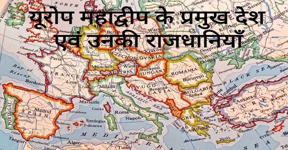
यूरोप महाद्वीप के प्रमुख देश एवं उनकी राजधानियाँ | Europe's Main Countries And Their Capitals
यहाँ यूरोप महाद्वीप के प्रमुख देश एवं उनकी राजधानियाँ दी गई हैं। Europe's Main Countries And Their Capitals given here.
Read more
जर्मनी (यूरोप) की भौगोलिक एवं राजनीतिक विशेषताएँ | Geographical And Political Features Of Germany (Europe)
जर्मनी यूरोप महाद्वीप के महत्वपूर्ण देशों में से एक है। इसके उत्तर-पश्चिम में उत्तर सागर स्थित है। जर्मनी के उत्तर-पूर्व में बाल्टिक सागर स्थित है।
Read more.jpg)
फ्रांस (यूरोप) की भौगोलिक एवं राजनीतिक विशेषताएँ | Geographical And Political Features Of France (Europe)
फ्रांस क्षेत्रफल की दृष्टि से यूरोप महाद्वीप का दूसरा सबसे बड़ा देश है। यूरोप महाद्वीप का सबसे बड़ा देश रूस है।
Read more