


भारत का भूगोल ~ प्रायद्वीपीय पठार (Geography of india ~ Peninsular Plateau)
भारतीय प्रायद्वीपीय पठार की आकृति 'अनियमित त्रिभुजाकार' है। इस पठार का विस्तार उत्तर-पश्चिम में अरावली पर्वत श्रेणी तथा दिल्ली, पूर्व में राजमहल की पहाड़ियों, पश्चिम की ओर गिर पहाड़ियों, दक्षिण दिशा में इलायची (कार्डमम) पहाड़ियों तथा पूर्वोत्तर में शिलांग तथा कार्बी-ऐंगलोंग के पठार तक है। इस पठार की ऊंचाई 6,00 से 9,00 मीटर है। यह प्रायद्वीपीय पठार 'गोंडवाना लैंड' के टूटकर उत्तर दिशा की ओर प्रवाहित होने के कारण बना था। यह प्राचीनतम भूभाग 'पैंजिया' का ही एक हिस्सा है। यह पुराने क्रिस्टलीय, आग्नेय एवं रूपांतरित शैलों से बना हुआ है। प्रायद्वीपीय पठार की ऊंचाई पश्चिम से पूर्व की ओर कम होती जाती है। इस वजह से प्रायद्वीपीय पठार की अधिकांश नदियों का प्रवाह पूर्व की ओर ही है। प्रायद्वीपीय पठार का ढाल उत्तर से पूर्व दिशा की ओर है। यह सोन, चंबल और दामोदर नदियों के प्रवाह से स्पष्ट हो जाता है। दक्षिणी भाग में पठार का ढाल पश्चिम से पूर्व दिशा की ओर है, जोकि कृष्णा, महानदी, गोदावरी और कावेरी नदियों के प्रवाह से स्पष्ट हो जाता है। प्रायद्वीपीय नदियों में 2 नदियों के अपवाह हैं। ये नदियाँ हैं- नर्मदा एवं ताप्ती। इनके बहने की दिशा पूर्व से पश्चिम की ओर है। तथा ये अंत में अरब सागर में गिरती हैं। ऐसा 'भ्रंश घाटी' से होकर बहने के कारण है। प्रायद्वीपीय पठार अनेक पठारों से मिलकर बना हुआ है, अतः इसे 'पठारों का पठार' भी कहते हैं। इसे हम चार भागों में वर्गीकृत कर सकते हैं :
1. केंद्रीय उच्च भूमि,
2. प्रायद्वीपीय पठार,
3. उत्तर-पूर्वी पठार,
4. दक्कन का पठार।
The shape of the Indian peninsular plateau is 'irregular triangular' . The plateau extends to the Aravalli mountain range in the north-west and Delhi, the Rajmahal hills to the east, the Gir hills to the west, the cardamom hills to the south and the plateau of Shillong and Karbi-Anglong in the northeast. The altitude of this plateau is 6,00 to 9,00 m . This peninsular plateau was formed by the breaking of the 'Gondwana Land' and flowing northwards. This ancient landmass is a part of 'Pangea' . It is made up of old crystalline, igneous and metamorphic rocks. The height of the peninsular plateau decreases from west to east. Because of this, most of the rivers in the peninsular plateau flow eastward. The slope of the peninsular plateau is from north to east. This is made clear by the flow of the Sone, Chambal and Damodar rivers. In the southern part, the slope of the plateau is from west to east direction, which is evident by the flow of Krishna, Mahanadi, Godavari and Kaveri rivers. The peninsular rivers have runoff of 2 rivers. These rivers are Narmada and Tapti . The direction of their flow is from east to west. And finally they fall into the Arabian Sea. This is due to the flow through the 'fault valley' . The peninsular plateau consists of several plateaus, so it is also known as 'plateau of plateaus' . We can classify it into four parts:
1. Central Highland,
2. Peninsular Plateau,
3. North-Eastern Plateau,
4. Deccan Plateau.
1. केंद्रीय उच्च भूमि- इसके अंतर्गत 6 क्षेत्रों को शामिल किया गया है-
अरावली पर्वत श्रेणी,
मेवाड़ का पठार,
मालवा का पठार,
बुंदेलखंड का पठार,
विंध्यन श्रेणी,
सतपुड़ा श्रेणी।
1. Central Highlands - It covers 6 areas-
Aravalli Range,
Mewar Plateau,
Malwa Plateau,
Bundelkhand plateau,
Vindhyan Range,
Satpura Range.
अरावली पर्वत श्रेणी- इस पर्वत श्रेणी का विस्तार पूर्वोत्तर में दिल्ली रिज से लेकर दक्षिण पश्चिम में गुजरात के पालनपुर तक है। इस पर्वत श्रंखला की लंबाई लगभग 8,00 किलोमीटर है। यह पर्वत श्रेणी 'अवशिष्ट पर्वत' का उदाहरण है, जो की प्राचीनतम मोड़दार पर्वत है। यह राजस्थान बांगर को केंद्रीय उच्च भूमि से अलग करता है। इस पर्वत श्रेणी की उत्पत्ति 'प्री-कैंब्रियन काल' में हुई थी। इसकी अनुमानित आयु 5,70 मिलीयन वर्ष है। अरावली श्रंखला पश्चिमी भारत का मुख्य जल विभाजक है। यह राजस्थान मैदान के अपवाह क्षेत्र को गंगा के मैदान के अपवाह क्षेत्र से अलग करती है। 'लूनी नदी' इस पर्वत श्रेणी से निकलती है। लूनी राजस्थान मैदान की सर्वाधिक महत्वपूर्ण नदी है। यह नदी राजस्थान बांगर और थार मरुस्थल से होते हुए कच्छ के रन में विलीन हो जाती है। अतः यह एक अंतः स्थलीय अपवाह तंत्र है। लूनी नदी की महत्वपूर्ण सहायक नदियाँ 'सुकरी' और 'जवाई' हैं। ये दोनों भी अरावली पर्वत श्रंखला से ही निकलती हैं। अरावली पर्वत श्रंखला पश्चिमी भारत की एक मुख्य जलवायु विभाजक भी है। यह पूर्व के अपेक्षाकृत अधिक वर्षा वाले क्षेत्र को पश्चिम के अर्ध शुष्क तथा शुष्क प्रदेश से अलग करती है। उत्तर पश्चिम में यह क्षेत्र खनिज संसाधनों की दृष्टि से अधिक महत्वपूर्ण है। यहां के प्रमुख खनिज ताँबा, सीसा, जस्ता, चूना पत्थर इत्यादि के भंडार हैं। अरावली पर्वत का सर्वोच्च शिखर 'गुरु शिखर' है। यह 'आबू पहाड़ी' पर स्थित है। आबू पहाड़ियों में जैनियों का प्रसिद्ध धर्म स्थल 'दिलवाड़ा जैन मंदिर' स्थित है। इसका अन्य शिखर 'कुंभलगढ़' है।
Aravalli Range - This mountain range extends from Delhi Ridge in the northeast to Palanpur in Gujarat in the southwest. The length of this mountain range is about 8,00 km . This mountain range is an example of 'residual mountain' , which is the oldest folded mountain. It separates Rajasthan Bangar from the central highlands. This mountain range originated in the 'Pre-Cambrian period' . It has an estimated age of 5,70 million years . The Aravali range is the main water divide in western India. It separates the drainage area of the Rajasthan plain from the drainage area of the Gangetic plain. 'Luni River' originates from this mountain range. Luni is the most important river in the Rajasthan plain. The river merges into the Kutch run through Rajasthan Bangar and Thar desert. Hence it is an inter-terrestrial drainage system. The important tributaries of Luni River are 'Sukri' and 'Jawai' . Both of these also originate from the Aravalli mountain range. The Aravalli mountain range is also one of the main climatic divisions of western India. It separates the region with relatively more rainfall in the east from the semi-arid and arid region of the west. This region in the North West is more important in terms of mineral resources. The major minerals here are reserves of copper, lead, zinc, limestone etc. The highest peak of the Aravalli mountain is 'Guru Shikhar' . It is located on 'Abu Pahari' . The famous Jain religious place 'Dilwara Jain Temple' is located in the Abu Hills. Its other peak is 'Kumbhalgarh' .
मेवाड़ का पठार- इस पठार का विस्तार मध्य प्रदेश तथा राजस्थान में है। मेवाड़ पठार अरावली पर्वत श्रृंखला को मालवा के पठार से अलग करता है। यह पठार अरावली पर्वत श्रंखला से निकलने वाली नदी 'बनास' के अपवाह क्षेत्र के अंतर्गत आता है बनास नदी चंबल नदी की एक सहायक नदी है।
Mewar Plateau - This plateau extends into Madhya Pradesh and Rajasthan. The Mewar plateau separates the Aravalli mountain range from the Malwa plateau. This plateau falls under the drainage area of the river 'Banas' originating from the Aravalli mountain range. The Banas River is a tributary of the Chambal River.
मालवा का पठार- यह पठार 'बेसाल्ट चट्टानों' से निर्मित है। यह 'मध्य प्रदेश' में स्थित है। इस पठार को राजस्थान में 'हाड़ौती का पठार' कहा जाता है। इस पठार का विस्तार दक्षिण में विंध्यन संरचना, उत्तर में ग्वालियर पहाड़ी क्षेत्र, पूर्व में बुंदेलखंड तथा बघेलखंड और पश्चिम में मेवाड़ पठारी क्षेत्र तक है। इस मालवा के पठार में 'काली मृदा' का सर्वाधिक विस्तार हुआ है। इसका कारण बेसाल्ट चट्टानों का अपक्षरण है। काली मिट्टी के होने के कारण इस पठारी क्षेत्र में कपास की खेती की जाती है। पठार की महत्वपूर्ण नदियाँ नर्मदा, तापी तथा चंबल हैं। भारत में अवनालिका अपरदन से सर्वाधिक प्रभावित क्षेत्र चंबल नदी घाटी है। इसे 'बीहड़' या 'उत्पात भूमि' भी कहा जाता है।
Malwa Plateau - This plateau is composed of 'basalt rocks' . It is located in 'Madhya Pradesh' . This plateau is called 'Hadoti Plateau' in Rajasthan. This plateau extends to the Vindhyan Formation in the south, Gwalior mountainous region in the north, Bundelkhand and Baghelkhand in the east and Mewar Plateau region in the west. The 'black soil' has the most expansion in this Malwa plateau. The reason for this is erosion of basalt rocks. Due to the black soil, cotton is cultivated in this plateau region. The important rivers of the plateau are Narmada, Tapi and Chambal . The most affected area of Avanalika erosion in India is the Chambal river valley. It is also called 'uncultivated' or 'great land'.
बुंदेलखंड का पठार- इस पठार का विस्तार ग्वालियर के पठार और विंध्याचल पर्वत श्रेणी के बीच है। यह पठार उत्तर प्रदेश तथा मध्य प्रदेश में स्थित है। इस पठार के अंतर्गत उत्तर प्रदेश के 7 जिले तथा मध्य प्रदेश के 8 जिले आते हैं-
Plateau of Bundelkhand - This plateau extends between the plateau of Gwalior and the Vindhyachal mountain range. This plateau is located in Uttar Pradesh and Madhya Pradesh. This plateau covers 7 districts of Uttar Pradesh and 8 districts of Madhya Pradesh-
उत्तर प्रदेश के जिले : ललितपुर, झांसी, जालौन, हमीरपुर, चित्रकूट, महोबा, बांदा।
मध्य प्रदेश के जिले : निवाड़ी, टीकमगढ़, छतरपुर, दतिया, पन्ना, विदिशा, दमोह, सागर।
इस पठार में लाल मृदा का विकास हुआ है। इसका कारण ग्रेनाइट व नीस चट्टानी संरचना में अपक्षय व अपरदन है। बुंदेलखंड के पठार में चंबल नदी के द्वारा बने महाखड्डों को 'उत्खात भूमि का प्रदेश' भी कहा जाता है। यह पठारी क्षेत्र आर्थिक दृष्टि से एक पिछड़ा क्षेत्र है, क्योंकि यह सूखा प्रभावित है।
Districts of Uttar Pradesh: Lalitpur, Jhansi, Jalaun, Hamirpur, Chitrakoot, Mahoba, Banda. Districts of Madhya Pradesh: Niwari, Tikamgarh, Chhatarpur, Datia, Panna, Vidisha, Damoh, Sagar. In this plateau Red soil has developed. This is due to weathering and erosion in granite and fine rock formations. The Mahakhadas formed by the Chambal River in the Bundelkhand plateau are also known as 'Territory of Uttarakhand' . This plateau region is economically a backward area, as it is drought-prone.
बघेलखंड का पठार मध्य प्रदेश तथा छत्तीसगढ़ की सीमा पर स्थित है। यह केंद्रीय उच्च भूमि को पूर्वी पठार से अलग करता है।
The plateau of Baghelkhand is situated on the border of Madhya Pradesh and Chhattisgarh. It separates the central highlands from the eastern plateau.
विंध्यन श्रेणी- विंध्यन श्रेणी का विस्तार गुजरात, उत्तर प्रदेश, मध्य प्रदेश, बिहार तथा छत्तीसगढ़ राज्यों में है। इस श्रेणी को गुजरात में 'जोबट हिल' कहा जाता है, तथा बिहार में 'कैमूर हिल' कहा जाता है। इस श्रेणी के दक्षिण में नर्मदा नदी घाटी स्थित है। यह नदी घाटी विंध्य पर्वत को सतपुड़ा पर्वत से अलग करती है। विंध्य श्रेणी में विंध्याचल, पारसनाथ तथा कैमूर की पहाड़ियाँ स्थित है। यह संरचना लाल बलुआ पत्थर तथा चूना पत्थर के चट्टान से निर्मित हुई है। इस पर्वत श्रेणी में धात्विक खनिज संसाधनों का अभाव है। इस श्रेणी से भवन निर्माण की सामग्रियाँ प्राप्त की जाती हैं।
Vindhyan Range - The Vindhyan category is spread over the states of Gujarat, Uttar Pradesh, Madhya Pradesh, Bihar and Chhattisgarh. This category is called 'Jobat Hill' in Gujarat, and ' Kaimur Hill ' in Bihar. To the south of this range lies the Narmada River Valley. This river valley separates the Vindhya mountain from the Satpura mountain. In the Vindhya Range, the hills of Vindhyachal, Parasnath and Kaimur are situated. This structure is made of red sandstone and limestone rock. This mountain range lacks metallic mineral resources. Building materials are obtained from this category.
सतपुड़ा श्रेणी- यह श्रेणी भारत के मध्य भाग में स्थित है। इसका विस्तार गुजरात, मध्य प्रदेश, महाराष्ट्र, छत्तीसगढ़ एवं छोटा नागपुर पठार में है। यह राजपिपला की पहाड़ी, मैकल श्रेणी एवं महादेव पहाड़ी के रूप में फैली हुई है। इस श्रेणी की सर्वोच्च चोटी 'धूपगढ़' है धूपगढ़ 'महादेव पर्वत' पर स्थित है। इसकी ऊंचाई 1,350 मीटर है। मैकल पर्वत श्रेणी की सर्वोच्च चोटी 'अमरकंटक' है। इसकी ऊंचाई 1,065 मीटर है। यहाँ से नर्मदा तथा सोन नदी का उद्गम हुआ है। सतपुड़ा पर्वत श्रेणी एक 'ब्लॉक पर्वत' है। इसका निर्माण ग्रेनाइट एवं बेसाल्ट चट्टानों से हुआ है। यह पर्वत श्रेणी नर्मदा तथा तापी नदियों के बीच जल विभाजक है।
Satpura Range - This category is located in the central part of India. It extends into Gujarat, Madhya Pradesh, Maharashtra, Chhattisgarh and Chota Nagpur Plateau. It extends as Rajpipala hill, Maikal range and Mahadev hill . The highest peak of this category is 'Dhupgarh' , Dhupgarh is situated on the 'Mahadev mountain' . Its height is 1,350 m . The highest peak of the Maikal mountain range is 'Amarkantak' . Its height is 1,065 m . Narmada and Son River originated from here. The Satpura mountain range is a 'block mountain' . It is formed from granite and basalt rocks. This mountain range is a water divide between the rivers Narmada and Tapi.
2. पूर्वी पठार- इसके अंतर्गत तीन क्षेत्रों को सम्मिलित किया गया है :
छोटा नागपुर का पठार, छत्तीसगढ़ बेसिन या महानदी बेसिन, दंडकारण्य का पठार।
(2. Eastern Plateau - It covers three areas:
Chota Nagpur Plateau, Chhattisgarh Basin or Mahanadi Basin, Dandakaranya Plateau.)
छोटानागपुर का पठार- इस पठार का विस्तार मुख्य रूप से झारखंड में है। इसके अतिरिक्त दक्षिणी बिहार, उत्तरी छत्तीसगढ़, पश्चिम बंगाल का पुरुलिया जिला और उड़ीसा का उत्तरी क्षेत्र भी छोटानागपुर पठार के अंतर्गत आता है। पठार के उत्तर पूर्व में राजमहल पहाड़ी, उत्तर में हजारीबाग का पठार, दक्षिण में रांची का पठार स्थित है। इन तीनों संरचनाओं को संयुक्त रूप से छोटानागपुर पठार क्षेत्र कहा जाता है। दामोदर नदी रांची के पठार को हजारीबाग के पठार से अलग करती है। यह पठार की सबसे बड़ी नदी है। कोयला भंडार की दृष्टि से भारत का सर्वाधिक महत्वपूर्ण क्षेत्र दामोदर नदी बेसिन है। 'पारसनाथ हिल' छोटानागपुर पठार की सबसे ऊँची चोटी है। यह हजारीबाग पठार पर स्थित है। यहां पर जैनियों का प्रसिद्ध तीर्थ स्थल है। राँची पठार से निकलने वाली स्वर्णरेखा नदी पठार की दूसरी सबसे बड़ी नदी है। इस स्वर्णरेखा नदी पर 'हुंडरू जलप्रपात' है। यह रांची के समीप स्थित है। छोटानागपुर पठारी क्षेत्र में ग्रेनाइट चट्टान से निर्मित स्थलाकृति को 'पाठ भूमि' कहा जाता है। पाठ भूमि 'उत्थित भूखंड' का उदाहरण है।
Chotanagpur Plateau - This plateau is mainly in Jharkhand. Apart from this, Purulia district of southern Bihar, northern Chhattisgarh, West Bengal and northern region of Odisha also come under Chhotanagpur plateau. To the north east of the plateau lies the Rajmahal hill , to the north Hazaribagh plateau , to the south is the Ranchi plateau . These three formations are jointly called the Chhotanagpur plateau region . The Damodar River separates the Ranchi plateau from the plateau of Hazaribagh . It is the largest river in the plateau. The most important area of India in terms of coal reserves is the Damodar River Basin. 'Parasnath Hill' is the highest peak of the Chotanagpur plateau. It is located on the Hazaribagh Plateau . There is a famous pilgrimage site of Jains here. The Swarnarekha River originating from the Ranchi Plateau is the second largest river in the plateau. This Swarnarekha River has 'Hundru Falls' . It is located near Ranchi. The topography formed from granite rock in the Chotanagpur plateau region is called 'text land' . The text is an example of land 'raised plot' .
छत्तीसगढ़ बेसिन या महानदी बेसिन- इस बेसिन का विस्तार छत्तीसगढ़ तथा उड़ीसा राज्य में है। इसका निर्माण अवतलन अथवा धँसाव की प्रक्रिया के कारण हुआ है। यह बेसिन महानदी के द्वारा छोटा नागपुर पठार के राँची पठार से अलग होता है। यह छोटा नागपुर के रांची पठार को दंडकारण्य पठार से भी अलग करता है। इस बेसिन में प्रवाहित होने वाली प्रमुख नदियाँ महानदी और उसकी सहायक नदियाँ शिवनाथ, हसदो, मांड, ईब आदि हैं। इस छत्तीसगढ़ या महानदी बेसिन में गोंडवाना क्रम की संरचना पाई जाती हैं। अतः यहां पर कोयला भंडार प्रचुर मात्रा में उपलब्ध है।
Chhattisgarh Basin or Mahanadi Basin - This basin is expanded in Chhattisgarh and Odisha state. It is formed due to the process of concavity or subsidence. This basin is separated from the Ranchi plateau of the Chota Nagpur Plateau by the Mahanadi. It also separates Ranchi plateau of Chota Nagpur from Dandakaranya plateau. The major rivers flowing in this basin are the Mahanadi and its tributaries Shivnath, Hasado, Mand, Ib etc. The structure of Gondwana sequence is found in this Chhattisgarh or Mahanadi Basin . Hence coal reserves are available here in plenty.
दंडकारण्य का पठार- इस पठार का विस्तार महाराष्ट्र, छत्तीसगढ़, उड़ीसा, आंध्र प्रदेश एवं तेलंगाना राज्यों में है। यह भारत के मध्यवर्ती भाग में स्थित है। यह पठारी क्षेत्र अत्यंत उबड़-खाबड़ एवं अनुपजाऊ है। यहां खनिज संसाधनों के भंडार उपलब्ध हैं। 'इंद्रावती नदी' का उद्गम इसी पठारी क्षेत्र से हुआ है। यह गोदावरी नदी की सहायक नदी है। इस दंडकारण्य पठार में 'बस्तर क्षेत्र' है जो कि टिन धातु के लिए प्रसिद्ध है।
Dandakaranya Plateau - The expansion of this plateau is Maharashtra, Chhattisgarh, Orissa, Andhra Pradesh and Telangana > States. It is located in the central part of India. This plateau area is extremely rugged and unproductive. Mineral resources reserves are available here. 'Indravati River' originates from this plateau region. It is a tributary of the Godavari River . This Dandakaranya plateau has a 'Bastar region' which is famous for tin metal .
3. उत्तर पूर्वी पठार- इस पठार के अंतर्गत मेघालय का पठार आता है :
(3. North Eastern Plateau - This plateau consists of Meghalaya Plateau:)
मेघालय का पठार- मेघालय का पठार छोटा नागपुर पठार का ही पूर्वी विस्तार है। यह 'राजमहल-गारो गैप' या 'मालदा गैप' के द्वारा प्रायद्वीपीय पठार से अलग हुआ है। इस पठार के पश्चिम से पूर्व की ओर क्रमशः गारो, खासी, जयंतिया एवं मिकिर पहाड़ियाँ स्थित है। ये सभी प्राचीन चट्टानों से निर्मित है। इस पठार की प्रमुख जनजातियाँ गारो, खासी एवं जयंतिया हैं। विश्व के सर्वाधिक वर्षा वाले क्षेत्र 'मासिनराम' तथा 'चेरापूंजी' इसी पठारी क्षेत्र में स्थित है। इस पठारी क्षेत्र का सबसे ऊँचा पर्वतीय क्षेत्र 'शिलांग रेंज' है। अतः इसे 'शिलांग का पठार' भी कहते हैं। इस क्षेत्र की सबसे ऊंची चोटी 'नाँकरेक' है। यह मेघालय राज्य में स्थित है। इस क्षेत्र में लेटराइट मिट्टी एवं सदाबहार वनों का विकास हुआ है, क्योंकि यहाँ पर औसत से अधिक वर्षा होती है।
Meghalaya Plateau - The Meghalaya Plateau is the easternmost extension of the Chota Nagpur Plateau. It is separated from the peninsular plateau by 'Rajmahal-Garo Gap' or 'Malda Gap' . From the west to the east of this plateau are located Garo, Khasi, Jaintia and Mikir hills respectively. It is all made of ancient rocks. The major tribes of this plateau are Garo, Khasi and Jaintia . The world's most rainy regions 'Masinram' and 'Cherrapunji' are located in this plateau region. The highest mountainous region of this plateau is the 'Shillong Range' . Hence it is also called 'Shillong Plateau' . The highest peak of this region is 'Nankrek' . It is located in the state of Meghalaya. The region has developed laterite soil and evergreen forests , as it receives above-average rainfall.
4. दक्कन का पठार- इस पठारी क्षेत्र का विस्तार तापी नदी के दक्षिण में है। इसका आकार त्रिभुजाकार है। इस पठारी क्षेत्र के अंतर्गत तीन क्षेत्रों को शामिल किया गया है :
(4. Deccan Plateau - This plateau area extends south of the Tapi River . Its shape is triangular . This plateau area covers three areas:)
दक्कन ट्रैप,
कर्नाटक का पठार,
आंध्र का पठार।
(Deccan Trap,
Karnataka Plateau,
Andhra plateau.)
दक्कन ट्रैप- दक्कन ट्रैप में 'काली मिट्टी' का विकास हुआ है क्योंकि यह बेसाल्ट चट्टान से निर्मित है। अतः यहाँ कपास की खेती की जाती है। इस क्षेत्र का विस्तार 16° उत्तरी अक्षांश के उत्तर से लेकर पूर्वोत्तर में नागपुर तक है। इस पठारी क्षेत्र में गोदावरी नदी प्रवाहित होती है। इस पठारी क्षेत्र की प्रमुख पहाड़ियाँ सतमाला, अजंता, बालाघाट एवं हरीश्चंद्र आदि हैं।
Deccan Trap - 'Black soil' has developed in the Deccan Trap because it is basalt rock >. Hence cotton cultivation is done here. The area extends from north of 16 ° north latitude to Nagpur in the northeast. The Godavari River flows in this plateau region. The major hills of this plateau region are Satmala, Ajanta, Balaghat and Harishchandra etc.
कर्नाटक का पठार- इस पठार में पश्चिमी घाट से संलग्न पर्वतीय एवं पठारी प्रदेश को 'मलनाड' कहा जाता है। यहाँ का सबसे ऊँचा पर्वती क्षेत्र 'बाबा बूदान' है तथा इसकी सबसे ऊँची चोटी 'मुल्लायानगिरी' है। मलनाड से जुड़े हुए पूर्व में अपेक्षाकृत कम ऊँचे पठारी क्षेत्र को 'मैदान' कहते हैं, जिसमें औसत से अधिक ऊँचे मैदानी भाग को 'मैसूर का पठार' तथा 'बेंगलुरु का पठार' कहा जाता है। यह पठार खनिज संसाधनों के भंडार की दृष्टि से अत्यंत महत्वपूर्ण है, क्योंकि यहाँ धारवाड़ संरचना का विकास हुआ है। इस पठारी क्षेत्र में लौह अयस्क सर्वाधिक उपलब्ध हैं। इस पठारी क्षेत्र में कावेरी नदी प्रवाहित होती है। इसके अतिरिक्त अन्य प्रमुख नदियाँ कावेरी, कृष्णा, शरावती, तुंगभद्रा और भीमा आदि हैं। शरावती नदी पर 'जोग या गरसोप्पा' जलप्रपात स्थित है। इस जलप्रपात को 'महात्मा गांधी' जलप्रपात के नाम से भी जाना जाता है। कुंचिकल जलप्रपात भारत का सबसे ऊंचा जलप्रपात है।यह 'वाराही नदी' पर स्थित है जो कि कर्नाटक के शिमोगा जिले में बहती है।
Plateau of Karnataka - In this plateau, the mountainous and plateau region enclosed by the Western Ghats is called 'Malnad' . The highest mountain area here is 'Baba Budan' and its highest peak is 'Mullayanagiri' . The relatively low elevation plateau area formerly associated with Malnad is called 'plain' , with the higher than average plains being 'Plateau of Mysore' and called the 'Plateau of Bengaluru' . This plateau is extremely important from the point of view of mineral resources, because the Dharwad structure has developed here. Iron ore is the most available in this plateau region. The Cauvery River flows in this plateau region. Apart from this, other major rivers are Kaveri, Krishna, Sharavati, Tungabhadra and Bhima etc. The 'Jog or Garsoppa' waterfall is located on the Sharavati river. This waterfall is also known as 'Mahatma Gandhi' waterfall. Kunchikal Falls is the highest waterfall in India. It is situated on the 'Varahi River' which flows in the Shimoga district of Karnataka.
आंध्र का पठार- इस पठार के अंतर्गत 'रायलसीमा का पठार' एवं 'तेलंगाना के पठार' को शामिल किया गया है। कृष्णा नदी बेसिन के दक्षिण में स्थित पठार को रायलसीमा का पठार कहा जाता है। इस क्षेत्र में वेलीकोंडा, पालगोंडा और नल्ला- मलाई पर्वत स्थित है। कृष्णा नदी बेसिन से उत्तर दिशा में स्थित पठार को तेलंगाना का पठार कहते हैं। तेलंगाना के पठार का ऊपरी हिस्सा पठारी है, तथा दक्षिणी हिस्सा उपजाऊ मैदान है। कृष्णा तथा गोदावरी नदी बेसिन के बीच में 'कोल्लेरू झील' स्थित है। यह एशिया की सबसे बड़ी दलदली भूमि है।
Andhra Plateau - Under this plateau, 'Rayalaseema Plateau' and 'Telangana Plateau' is included. The plateau to the south of the Krishna River Basin is called the Plateau of Rayalaseema . The region consists of Velikonda, Palgonda and Nalla-Malai Mountains . The plateau to the north of the Krishna river basin is called Telangana plateau . The upper part of Telangana plateau is plateau, and the southern part is fertile plains. Between the Krishna and Godavari river basins is the 'Kolleru lake' . It is the largest marshland in Asia.
RF competition
INFOSRF.COM
संबंधित जानकारी नीचे देखें।
(Watch related information below) 👇🏻

आशा है, उपरोक्त जानकारी उपयोगी एवं महत्वपूर्ण होगी।
(I hope the above information will be useful and important. )
Thank you.
लेखक
(Writer)
infosrf.com
पाठकों की टिप्पणियाॅं (0)
You may also like
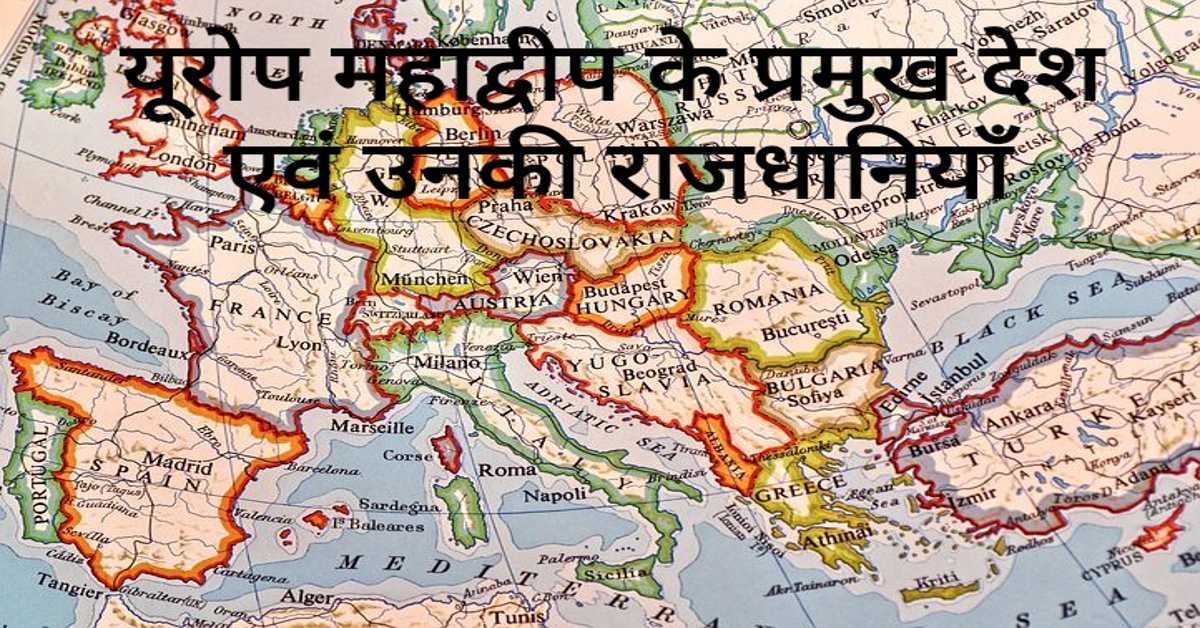
यूरोप महाद्वीप के प्रमुख देश एवं उनकी राजधानियाँ | Europe's Main Countries And Their Capitals
यहाँ यूरोप महाद्वीप के प्रमुख देश एवं उनकी राजधानियाँ दी गई हैं। Europe's Main Countries And Their Capitals given here.
Read more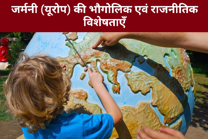
जर्मनी (यूरोप) की भौगोलिक एवं राजनीतिक विशेषताएँ | Geographical And Political Features Of Germany (Europe)
जर्मनी यूरोप महाद्वीप के महत्वपूर्ण देशों में से एक है। इसके उत्तर-पश्चिम में उत्तर सागर स्थित है। जर्मनी के उत्तर-पूर्व में बाल्टिक सागर स्थित है।
Read more.jpg)
फ्रांस (यूरोप) की भौगोलिक एवं राजनीतिक विशेषताएँ | Geographical And Political Features Of France (Europe)
फ्रांस क्षेत्रफल की दृष्टि से यूरोप महाद्वीप का दूसरा सबसे बड़ा देश है। यूरोप महाद्वीप का सबसे बड़ा देश रूस है।
Read more