
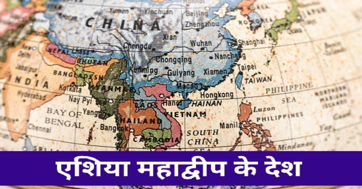


एशिया महाद्वीप के महत्वपूर्ण देश | Important Countries of the Continent of Asia
एशिया महाद्वीप के महत्वपूर्ण देशों का विवरण यहाँ दिया गया है। नेपाल, भूटान, म्यांमार, चीन,, अफगानिस्तान, बांग्लादेश आदि का वर्णन किया गया है।
एशिया महाद्वीप विश्व का सबसे बड़ा महाद्वीप है। इस महाद्वीप में कई देश है। भारत अन्य महत्वपूर्ण देशों की तरह एक महत्वपूर्ण देश है। किंतु यहाँ पर भारत के संदर्भ में विवरण नहीं दिया गया है। भारत के संदर्भ में इस infosrf.com वेबसाइट पर बहुत सारे लेख उपलब्ध हैं। परीक्षार्थी उन लेखों से भारत के संदर्भ में अध्ययन करें। यहाँ केवल एशिया महादीप के अन्य देशों के बारे में जानकारी दी गई है।
भूटान- भूटान एशिया महाद्वीप में पूर्वी हिमालय पर स्थित है। यह एक स्थल अवरुद्ध देश है। इसके पूर्व में भारत का अरुणाचल प्रदेश ,पश्चिम में सिक्किम और दक्षिण में असम तथा पश्चिम बंगाल राज्य स्थित है। इसके अतिरिक्त इसके उत्तर में तिब्बत (चीन) है। भूटान एक पर्वतीय देश है। इसकी सबसे ऊँची पर्वत चोटी 'गांकर पुनसुम' या 'कुलाकांगड़ी' है। भूटान की राजधानी 'थिंफू' है। इसे 'लैंड ऑफ़ थंडरवोल्ट' के नाम से जाना जाता है। भूटान की प्रमुख नदियाँ संकोश, वॉग्चू तथा मानस हैं। इनकी सहायता से जल विद्युत का उत्पादन किया जाता है। भूटान ने भारत से सहायता प्राप्त कर संकोश, चूखा, मांगदेचु और ताता जलविद्युत परियोजना का विकास किया है। भूटान में भोटिया नृजाति समूह की प्रधानता है। यहाँ की अर्थव्यवस्था कृषि, वन संसाधन, पर्यटन तथा जलविद्युत ऊर्जा पर आधारित हैं। भूटान संसार का एकमात्र ऐसा देश है जो अपने आर्थिक विकास की माप राष्ट्रीय खुशहाली के आधार पर करता है।
Bhutan- Bhutan is located on the eastern Himalayas in the continent of Asia. This is a landlocked country. Arunachal Pradesh of India is situated in the east, Sikkim in the west and the states of Assam and West Bengal in the south. Apart from this, there is Tibet (China) in its north. Bhutan is a mountainous country. Its highest mountain peak is 'Gankar Punsum' or 'Kulakangdi'. The capital of Bhutan is 'Thimphu'. It is known as 'Land of Thundervolt'. The major rivers of Bhutan are Sankosh, Wogchu and Manas. With their help, hydroelectricity is produced. Bhutan has developed the Sankosh, Chukha, Mangdechu and Tata hydroelectric projects with assistance from India. The Bhotia ethnic group predominates in Bhutan. Its economy is based on agriculture, forest resources, tourism and hydroelectric energy. Bhutan is the only country in the world that measures its economic development on the basis of national prosperity.
नेपाल- यह एक पर्वतीय देश है। यह चीन तथा भारत के बीच 'बफर स्टेट' के रूप में विद्यमान है। नेपाल की सीमा भारत के उत्तर प्रदेश, उत्तराखंड, बिहार, सिक्किम तथा पश्चिम बंगाल राज्यों से लगी हुई है। नेपाल की प्रमुख नदियाँ बागमती, कोसी, काली, गंडक, करनाली, अरुण आदि हैं। नेपाल में जल विद्युत उत्पादन होता है। देश में इसके द्वारा ऊर्जा प्राप्ति की अपार संभावनाएँ हैं। किंतु नेपाल इस क्षमता का कम प्रयोग ही कर पा रहा है। नेपाल में हिमालय पर्वत श्रंखला की वृहद्, लघु तथा शिवालिक तीनों श्रेणियाँ हैं। नेपाल की प्रमुख चोटियाँ माउंट एवरेस्ट, कंचनजंगा, धौलागिरी, मकालू, अन्नपूर्णा, गौरीशंकर आदि हैं। धौलाधार (मध्य हिमालय) को नेपाल में 'महाभारत श्रेणी' के नाम से जाना जाता है। कंचनजंगा नेपाल तथा सिक्किम के मध्यवर्ती क्षेत्र में स्थित है। यहाँ की प्रमुख जनजातियाँ नेपाली, गोरखा, नीवार, भूटिया, शेरपा आदि हैं। नेपाल की राष्ट्रीय भाषा 'नेपाली' है। इसकी राजधानी 'काठमांडू' है। यह देश का सबसे बड़ा शहर है। नेपाल का एकमात्र औद्योगिक शहर 'विराटनगर' है। देश का प्रमुख उद्योग पर्यटन है। यहाँ मिट्टी के बर्तन के लिए 'थिमी' प्रसिद्ध है। नेपाल ने भारत सरकार की सहायता से कोसी, त्रिशूली, पंचेश्वर, नाउमूरे, सप्तकोशी जैसी परियोजनाओं से लाभ प्राप्त किया है। नेपाल के प्रमुख पर्यटक स्थल काठमांडू घाटी, चितवन नेशनल पार्क और सागरमाथा नेशनल पार्क तथा लुंबिनी हैं। यूनेस्को ने इन्हें विश्व विरासत सूची में सम्मिलित किया है।
Nepal- It is a mountainous country. It exists as a 'buffer state' between China and India. Nepal is bordered by the Indian states of Uttar Pradesh, Uttarakhand, Bihar, Sikkim and West Bengal. Major rivers of Nepal are Bagmati, Kosi, Kali, Gandak, Karnali, Arun etc. Hydropower generation takes place in Nepal. There is immense potential for energy generation in the country. But Nepal is making little use of this potential. There are three major, minor and Shivalik ranges of the Himalayan mountain range in Nepal. Major peaks of Nepal are Mount Everest, Kanchenjunga, Dhaulagiri, Makalu, Annapurna, Gaurishankar etc. The Dhauladhar (Central Himalayas) is known as 'Mahabharata Range' in Nepal. Kangchenjunga is situated between Nepal and Sikkim. The major tribes here are Nepali, Gorkha, Niwar, Bhutia, Sherpa etc. The national language of Nepal is 'Nepali'. Its capital is 'Kathmandu'. It is the largest city in the country. 'Viratnagar' is the only industrial city of Nepal. The main industry of the country is tourism. Here 'Thimi' is famous for pottery. Nepal has benefited from projects like Kosi, Trishuli, Pancheshwar, Naumure, Saptakoshi with the help of Government of India. The major tourist places in Nepal are Kathmandu Valley, Chitwan National Park and Sagarmatha National Park and Lumbini. UNESCO has included them in the World Heritage List.
ब्रह्माण्ड एवं खगोल विज्ञान के इन 👇 प्रकरणों के बारे में भी जानें।
1. ब्रह्माण्ड की उत्पत्ति
2. खगोलीय पिण्ड
3. तारों का जन्म एवं मृत्यु
4. सौरमंडल की संरचना
5. सौरमंडल के पिण्ड
6. सौर मंडल के ग्रह एवं उपग्रह की विशेषताएँ
पाकिस्तान- यह दक्षिणी एशिया में स्थित है। देश के पश्चिम में ईरान, उत्तर-पश्चिम में अफगानिस्तान, दक्षिण-पूर्व में भारत तथा दक्षिण में अरब सागर है। यह एक इस्लामी गणराज्य है। पाकिस्तान की प्रमुख नदी 'सिंधु' है। इस नदी के द्वारा निर्मित मैदान को 'सिंधु के मैदान' के नाम से जाना जाता है। यह मैदान देश का सबसे उपजाऊ क्षेत्र है। पाकिस्तान को नहरों का देश कहा जाता है, क्योंकि सिंधु और इसकी सहायक नदियाँ अनेक नहरों का निर्माण करती हैं। पाकिस्तान की प्रमुख पर्वत श्रेणियाँ हिंदूकुश, सुलेमान तथा किरथर हैं। यहाँ की सर्वोच्च चोटी हिंदूकुश पर्वत की 'तिरिचमीर' है। इसकी ऊँचाई 7708 मीटर है। पाकिस्तान के प्रमुख दर्रे 'खैबर' (हिंदूकुश श्रेणी) तथा 'बोलन' (किरथर श्रेणी) हैं। देश के उत्तरी-पश्चिमी क्षेत्र में 'स्वात घाटी' अवस्थित है। इसे 'पाकिस्तान का स्वर्ग' के नाम से जाना जाता है। यहाँ का अत्यंत महत्वपूर्ण 'साल्टरेंज' है। यह सेंधा नमक, चूना पत्थर तथा जिप्सम के लिए प्रसिद्ध है। 'जकौबाबाद' यहाँ का प्रमुख मरुस्थलीय क्षेत्र है। यह विश्व के सबसे गर्म स्थानों में से एक है। पाकिस्तान में अनेक उद्योगों का विकास हुआ है। अतः यह एक नगरीकृत देश है। पाकिस्तान के प्राकृतिक गैस उत्पादन के प्रमुख क्षेत्र 'सुई' तथा 'मियाल' हैं। इसके अतिरिक्त देश का 'क्वेटा' क्षेत्र कोयले के लिए महत्वपूर्ण है। पाकिस्तान का सबसे बड़ा नगर 'कराची' है। 'इस्लामाबाद' इसकी राजधानी है। यहाँ के अधिकतर निवासी 'इस्लाम धर्म' के अनुयायी हैं। देश की राष्ट्रीय भाषा उर्दू है।
Pakistan- It is located in Southern Asia. The country is bordered by Iran to the west, Afghanistan to the northwest, India to the southeast and the Arabian Sea to the south. It is an Islamic republic. The main river of Pakistan is 'Indus'. The plain formed by this river is known as 'Indus plain'. This plain is the most fertile region of the country. Pakistan is called the country of canals because the Indus and its tributaries form many canals. The major mountain ranges of Pakistan are Hindu Kush, Sulaiman and Kirthar. The highest peak here is 'Tirichmir' of Hindukush mountain. Its height is 7708 meters. The major passes of Pakistan are 'Khyber' (Hindu Kush Range) and 'Bolan' (Kirthar Range). 'Swat Valley' is located in the North-Western region of the country. It is known as 'Pakistan's paradise'. The most important thing here is 'Saltrange'. It is famous for rock salt, limestone and gypsum. 'Jakobabad' is the major desert area here. It is one of the hottest places in the world. Many industries have developed in Pakistan. Hence it is an urbanized country. The major areas of natural gas production in Pakistan are 'Sui' and 'Mial'. In addition the 'Quetta' region of the country is important for coal. The largest city of Pakistan is 'Karachi'. 'Islamabad' is its capital. Most of the residents here are followers of 'Islam religion'. The national language of the country is Urdu.
चीन- चीन का विश्व में जनसंख्या की दृष्टि से प्रथम तथा क्षेत्रफल की दृष्टि से चौथा स्थान है। चीन के उत्तरी भाग में एक पठार है। यह मंगोलिया का हिस्सा है। यहाँ पर गोबी का मरुस्थल स्थित है। यह एक ठंडा मरुस्थल है। देश के पश्चिमी क्षेत्र में 'ज़ंगारिया बेसिन' स्थित है। यह मदध्य एशिया तथा चीन के बीच एक प्रवेश द्वार है। तिब्बत के पश्चिमी पठारी क्षेत्र से सिंधु, सतलुज, सांगपो (ब्रह्मपुत्र) नदियों का उद्गम हुआ है। इसके अतिरिक्त देश के पूर्वी पठारी क्षेत्र से सालविन और मेकॉन्ग नदी का उद्गम हुआ है। चीन में 'लोएस' मृदा से पठारी क्षेत्र का निर्माण हुआ है। यहाँ से 'हांगह्वो' नदी का प्रवाह होता है। चीन में अधिकांश वर्षा ग्रीष्म ऋतु में होती है, क्योंकि यहाँ की जलवायु शीतोष्ण मानसूनी है। देश में वर्षा की मात्रा पूर्व से पश्चिम तथा दक्षिण से उत्तर की ओर कम होती जाती है। देश के दक्षिण-पूर्वी क्षेत्र में पतझड़ वनों का तथा उत्तर-पश्चिम क्षेत्र में स्टेपी और मरुस्थलीय वनस्पति का विस्तार हुआ है। चीन में जुंगारियन पर्वत श्रेणी स्थित है। यह देश की वनस्पतियों को दो भागों में वर्गीकृत करती है। चीन के कुल क्षेत्रफल का केवल 15% ही कृषि योग्य है। यहाँ पर रासायनिक उर्वरकों, कीटनाशकों और उन्नत किस्म के बीजों का अत्यधिक प्रयोग किया जाता है। इस वजह से संपूर्ण विश्व में खाद्यान्न उत्पादन में अग्रणी देश बन गया है। यह खनिज संसाधनों की दृष्टि से महत्वपूर्ण देश है। यहाँ के प्रमुख संसाधन लौह अयस्क, कोयला, टंगस्टन, मैग्नीज़, सीमेंट, एल्युमीनियम, जिप्सम, स्वर्ण, कैडमियम, अभ्रक, लेड, ग्रेफाइट, टिन, जिंक और मैग्नीशियम है। इन सब की उत्पादन में चीन का विश्व में अग्रणी स्थान है। 'शंघाई' यहाँ का सबसे बड़ा पत्तन है। यह सूती वस्त्र उद्योग केंद्र है। कागज, रेशम तथा बारूद का सर्वप्रथम उत्पादन चीन में ही किया गया था। इसे सोयाबीन और चाय के जन्म भूमि के नाम से जाना जाता है। देश में वृहद् तेल भंडार व उत्पादन हेतु 'डकांग' क्षेत्र प्रसिद्ध है। चीन की राजधानी 'बीजिंग' है। यह जलपोत निर्माण और वस्त्र निर्माण का महत्वपूर्ण केंद्र है। चीन में पर्ल नदी बहती है। इसके द्वारा निर्मित 'पर्ल नदी डेल्टाई क्षेत्र' संसार का सबसे बड़ा शहरी क्षेत्र बन चुका है। चीन 'ताइवान' को अपने अधिकार में बताता है। किंतु यह स्वतंत्र देश है। यह मुख्य भूमि से दूर 'फॉरमोसा द्वीप' पर स्थित है।
China- China ranks first in the world in terms of population and fourth in terms of area. There is a plateau in the northern part of China. It is part of Mongolia. Here is located Gobi desert. It is a cold desert. 'Zangaria Basin' is located in the western region of the country. It is a gateway between Central Asia and China. The Indus, Sutlej, Tsangpo (Brahmaputra) rivers originate from the western plateau region of Tibet. Apart from this, the Salwin and Mekong rivers originate from the eastern plateau region of the country. In China, the plateau area has been formed from 'loes' soil. From here the 'Hanghua' river flows. Most of the rainfall in China occurs in the summer because the climate here is temperate monsoon. The amount of rainfall in the country decreases from east to west and from south to north. In the south-eastern region of the country deciduous forests and in the north-west region there is an expansion of steppe and desert vegetation. Jungarian mountain range is located in China. It categorizes the flora of the country into two parts. Only 15% of China's total area is arable. Chemical fertilizers, pesticides and improved quality seeds are used extensively here. Because of this, it has become a leading country in the production of food grains all over the world. It is an important country in terms of mineral resources. The major resources here are iron ore, coal, tungsten, manganese, cement, aluminium, gypsum, gold, cadmium, mica, lead, graphite, tin, zinc and magnesium. China has a leading position in the world in the production of all these. 'Shanghai' is the largest port here. It is the center of cotton textile industry. Paper, silk and gunpowder were first produced in China. It is known as the birth land of soybean and tea. 'Dakang' area is famous for large oil reserves and production in the country. The capital of China is 'Beijing'. It is an important center for shipbuilding and textile manufacturing. The Pearl River flows in China. The 'Pearl River Delta region' created by it has become the largest urban area in the world. China claims 'Taiwan' in its own right. But it is a free country. It is located on 'Formosa Island' off the mainland.
पृथ्वी की संरचना एवं इस पर होने वाली हलचलों से संबंधित इन 👇 प्रकरणों के बारे में भी जानें।
1. पृथ्वी की संरचना
2. पृथ्वी की गतियाँ
3. अक्षांश एवं देशांतर रेखाएँ
4. भूकंप एवं भूकम्पीय तरंगे
5. सुनामी और ज्वालामुखी क्या है
6. पृथ्वी पर ज्वार भाटा
7. ग्रहण, ऋतु परिवर्तन विषुव एवं सुपरमून
चीन से संबंधित महत्वपूर्ण तथ्य निम्नलिखित हैं-
1. मुख्य भाषा- मंदारिन
2. मैनचेस्टर- शंघाई
3. वाटिका- लाल बेसिन
4. सबसे बड़ी एंटीमनी की खान- शिक्वांगशान (यून्नान प्रांत)
5. शान्सी, सेन्सी- कोयला उत्पादन के लिए प्रसिद्ध है।
6. पालना- वी-हो नदी
7. पिट्सबर्ग- शेन्यास प्रांत
8. पीली नदी- हांगह्वो नदी
9. नानकिंग राज्य- सूती वस्त्र उद्योग हेतु प्रसिद्ध
10. टंगस्टन उत्पादक क्षेत्र- क्यांगसी प्रांत
The following are important facts related to China-
1. Main language- Mandarin
2. Manchester- Shanghai
3. Vatika- Red Basin
4. Largest Antimony Mine- Shiquangshan (Yunnan Province)
5. Shansi, Sensi- Famous for coal production.
6. Cradle- Wei-Ho River
7. Pittsburgh- Shenyas Province
8. Yellow River- Hongzhou River
9. Nanking State- Famous for cotton textile industry
10. Tungsten Producing Area- Kyangxi Province
चीन के कृषि उत्पादक क्षेत्र निम्नलिखित हैं-
1. चाय- जेचवान बेसिन, यांग्त्सीक्यांग घाटी
2. तंबाकू- दक्षिणी चीन
3. कपास- यांग्त्सीक्यांग घाटी, हांगह्वो घाटी
4. गेहूँ- पुन्नान, होन्नान तथा शान्सी
5. चावल- जेचवान, यांग्त्सीक्यांग घाटी
6. सोयाबीन- दक्षिणी चीन
The agricultural producing areas of China are-
1. Tea-Jechwan Basin, Yangtxiang Valley
2. Tobacco- Southern China
3. Cotton- Yangtxiang Valley, Hangzhou Valley
4. Wheat- Punnan, Honnan and Shansi
5. Rice- Zechwan, Yangtxiang Valley
6. Soybeans- Southern China
म्यांमार- यह भारत और बांग्लादेश के पूर्व में एवं चीन के दक्षिण में स्थित है। इसकी पूर्वी सीमा लाओस तथा थाईलैंड से मिलती है। म्यांमार को 'स्वर्ण पैगोडा का देश' के नाम से जाना जाता है। यहाँ की प्रमुख पर्वत श्रेणी 'अराकानयोमा' है। यह हिमालय पर्वत श्रृंखला का पूर्वी मोड़ है। यहाँ की सर्वोच्च चोटी 'हकाकाबोराजी' है। इसकी ऊँचाई 5,881 मीटर है। देश का पूर्वी भाग कम ऊँचाई वाला और पठारी है। यहाँ पर 'शान पठार' तथा 'कामिन्नी पठार' महत्वपूर्ण है। देश के बीच का भाग नदियों के निक्षेपों से बना हुआ है। म्यांमार की प्रमुख नदियाँ सालवीन, इरावदी और सितांग है। सालवीन तथा इरावदी नदियों के दोआब को पूर्व का 'चावल का कटोरा' के नाम से जाना जाता है। सालवीन नदी के पूर्व में 'सुनहरी त्रिभुज' अवस्थित है। यह अफीम की खेती के लिए महत्वपूर्ण है। इरावदी नदी को म्यांमार की जीवन रेखा कहा जाता है। यहाँ के डेल्टाई क्षेत्र में सुंदरी के वृक्ष पाए जाते हैं। म्यांमार सागौन की लकड़ी हेतु विश्व प्रसिद्ध है। खनिज संसाधनों की दृष्टि से यह महत्वपूर्ण देश है। यहाँ शान पठार में माणिक और नीलम जैसे कीमती पत्थर प्राप्त होते हैं। इसके अतिरिक्त मर्तबान की खाड़ी मोतियों के लिए महत्वपूर्ण है। चिंदविन और मोन्यवा के संगम पर कोयले का भंडार उपलब्ध हैं। इसके अतिरिक्त इरावती नदी पेट्रोलियम के लिए प्रसिद्ध है। मांडले इरावदी नदी के तट पर बसा महत्वपूर्ण नगर है। यांगून यहाँ का महत्वपूर्ण पत्तन है। म्यांमार में 'प्यू शहर' है। यह विश्व विरासत सूची में सम्मिलित है। देश की 'इनले झील' यहाँ का 'जैवमंडल अभयारण्य क्षेत्र' है। देश की अधिकांश जनसंख्या बौद्ध धर्म के अनुयायी है। इसके अतिरिक्त देश के पूर्वी भाग रखाईन प्रांत में अल्पसंख्यक समुदाय रोहिंग्या मुसलमान रहते हैं।
Myanmar- It is situated to the east of India and Bangladesh and to the south of China. Its eastern border is with Laos and Thailand. Myanmar is known as 'Land of the Golden Pagoda'. The major mountain range here is 'Arakanyoma'. It is the eastern turning point of the Himalayan mountain range. The highest peak here is 'Hakakaboraji'. Its height is 5,881 meters. The eastern part of the country is low altitude and plateau. Here 'Shan Plateau' and 'Kamineni Plateau' are important. The central part of the country is made up of deposits of rivers. The major rivers of Myanmar are Salvin, Irrawaddy and Sitang. The Doab of the Salvin and Irrawaddy rivers is known as the 'rice bowl' of the East. 'Golden Triangle' is situated to the east of Salvin River. It is important for the cultivation of opium. The Irrawaddy River is called the lifeline of Myanmar. Sundari trees are found in the deltaic region here. Myanmar is world famous for teak wood. It is an important country in terms of mineral resources. Precious stones like ruby and sapphire are found here in the Shan plateau. In addition, the bay of the jar is important for pearls. Coal deposits are available at the confluence of Chindwin and Monywa. Apart from this, the Iravati river is famous for petroleum. Mandala is an important city situated on the banks of Irrawaddy river. Yangon is an important port here. 'Pyu City' is in Myanmar. It is included in the World Heritage List. The country's 'Inle Lake' here is the 'Biosphere Sanctuary Area'. Majority of the population of the country are followers of Buddhism. Apart from this, the minority community Rohingya Muslims live in the eastern part of the country in Rakhine province.
ऋतुओं एवं जलवायु से संबंधित इन 👇 प्रकरणों के बारे में भी जानें।
1. भारत की प्रमुख ऋतुएँ
2. भारत की जलवायु का वर्गीकरण
3. मानसून- भारत की जलवायु
4. 5. वर्षा के प्रकार संवहनीय, पर्वतीय, चक्रवाती वर्षा
5. संघनन क्या है- संघनन के विभिन्न रूप
बांग्लादेश- यह गंगा-ब्रह्मपुत्र डेल्टा पर स्थित है। यह विश्व का सबसे बड़ा डेल्टा है। बांग्लादेश में विभिन्न नदियाँ प्रवाहित होती हैं। अतः इसे 'नदियों का देश' के नाम से भी जाना जाता है। यहाँ की प्रमुख नदियाँ गंगा, ब्रह्मपुत्र, सुरमा, मेघना आदि हैं। बांग्लादेश में ब्रह्मपुत्र को 'जमुना' कहा जाता है। जब जमुना गंगा में सम्मिलित हो जाती है, तब इस नवीन नदी को 'पद्मा' कहा जाता है। आगे चलकर जब पद्मा नदी मेघना से मिल जाती है तो इसका नाम बदलकर 'मेघना' हो जाता है। बांग्लादेश में संसार का सबसे बड़ा बलुई पुलिन 'कॉक्स बाज़ार' है। यहाँ की जलवायु उष्णकटिबंधीय मानसूनी है। अधिकांश क्षेत्र में वर्षा दक्षिणी-पश्चिमी मानसून से होती है। देश के तटीय क्षेत्रों में उष्णकटिबंधीय चक्रवात प्रभावशाली रहते हैं। यहाँ की नदियों में वर्ष भर पानी रहता है। इस कारण यहाँ जलीय परिवहन का विकास हुआ है। देश का सबसे बड़ा पत्तन 'चटगाँव' है। बांग्लादेश में गुलाबी मोती और जूट का उत्पादन होता है। देश के तटीय क्षेत्रों में सुंदरी वृक्ष पाए जाते हैं। बांग्लादेश के पहाड़पुर में स्थित 'बौद्ध विहार के खंडहर' और 'सुंदरबन' को यूनेस्को ने विश्व विरासत सूची में सम्मिलित किया है। बांग्लादेश बिम्सटेक और दक्षेस का सदस्य है।
Bangladesh- It is situated on the Ganges-Brahmaputra delta. It is the largest delta in the world. Various rivers flow through Bangladesh. Hence it is also known as 'country of rivers'. The major rivers here are Ganga, Brahmaputra, Surma, Meghna etc. In Bangladesh the Brahmaputra is called 'Jamuna'. When the Jamuna joins the Ganges, this new river is called 'Padma'. Later on, when the river Padma joins the Meghna, its name is changed to 'Meghna'. The world's largest sand bridge 'Cox's Bazar' is in Bangladesh. The climate here is tropical monsoon. Most of the region receives rainfall from the south-west monsoon. Tropical cyclones dominate the coastal areas of the country. The rivers here have water throughout the year. Due to this the development of aquatic transport has taken place here. The largest port of the country is 'Chittagong'. Pink pearls and jute are produced in Bangladesh. Sundari trees are found in the coastal areas of the country. The 'Buddhist Vihara Ruins' and 'Sunderbans' located in Paharpur, Bangladesh have been included in the UNESCO World Heritage List. Bangladesh is a member of BIMSTEC and SAARC.
श्रीलंका- यह एक द्वीपीय देश है। इसे रत्नद्वीप, सिंहल द्वीप, पूर्व का मोती, तपोवन आदि नामों से भी जाना जाता है। भारत और श्रीलंका के बीच पाक जलडमरूमध्य जलसंधि है। श्रीलंका के पश्चिम में मन्नार की खाड़ी तथा दक्षिण में हिंद महासागर है। श्रीलंका के तलैयामन्नार तथा भारत के धनुष्कोंडी के बीच 'आदम का पुल' स्थित है। यह प्रवाल द्वीप से निर्मित है। श्रीलंका का अधिकांश भाग कठोर चट्टानों से बना हुआ है। देश के केवल उत्तर में स्थित जायना प्रायद्वीप तथा तटीय क्षेत्रों में कठोर चट्टाने नहीं है। नदियों के द्वारा निर्मित जलोढ़ मैदानी क्षेत्र देश का सबसे उपजाऊ क्षेत्र है। श्रीलंका की सबसे लंबी नदी 'महावेली गंगा' है। इसके अतिरिक्त यहाँ की सबसे ऊँची चोटी 'पिदुरुतालागाला' है। इसकी ऊँचाई 2,527 मीटर है। श्रीलंका में अरीय अपवाह प्रणाली पाई जाती है। यहाँ की जलवायु उष्णकटिबंधीय मानसूनी है। चूँकि यह चारों ओर से समुद्र से घिरा हुआ है। अतः यहाँ समुद्री समकारी प्रभाव पाया जाता है। यहाँ पर वार्षिक तापांतर नगण्य रहता है। श्रीलंका दक्षिणी-पश्चिमी मानसून और उत्तर-पूर्वी मानसून दोनों से वर्षा प्राप्त करता है। यहाँ की प्रमुख वनस्पति सवाना वनस्पति है। यहाँ का प्रमुख खाद्य पदार्थ चावल है। इसके अतिरिक्त यहाँ की प्रमुख व्यापारिक फसलें चाय, रबड़, नारियल और कहवा हैं। चाय निर्यात के क्षेत्र में श्रीलंका विश्व में अग्रणी देश है। श्रीलंका में मुख्य तटीय नगरों को जोड़ने के लिए सड़क परिवहन का विकास हुआ है। इसके अतिरिक्त यहाँ जल परिवहन भी है। उत्तर-पूर्वी तट पर ट्रिकोमाली और पश्चिमी तट पर कोलंबो देश के प्रमुख पत्तन हैं। कोलंबो श्रीलंका की पूर्व राजधानी है। वर्तमान में यह देश की आर्थिक राजधानी है। इसके साथ ही यह श्रीलंका का सबसे बड़ा शहर है। यह 'केनाली नदी' के तट पर अवस्थित है। श्रीलंका की प्राचीन राजधानी 'कैंडी' थी। वर्तमान में देश की विधायी राजधानी 'श्री जयवर्ध्दनेपुरा कोटे' है। जाफना प्रायद्वीप देश की मुख्य भूमि से एलिफेंटा दर्रे से जुड़ा हुआ है। वर्तमान में कच्चातिवू द्वीप के स्वामित्व को लेकर भारत-श्रीलंका के बीच विवाद है। इस द्वीप को भारत ने सन् 1974 में श्रीलंका को दे दिया था। इसके अतिरिक्त पर्यावरण संरक्षण से संबंधित हाल के श्रीलंकाई वैधानिक प्रावधान ने भारतीय मछुआरों की समस्या को बढ़ा दिया है।
Sri Lanka- It is an island country. It is also known as Ratnadweep, Sinhala Island, Pearl of the East, Tapovan etc. Between India and Sri Lanka is the Pak Strait Strait. To the west of Sri Lanka lies the Gulf of Mannar and to the south is the Indian Ocean. 'Adam's bridge' is situated between Talaiyamannar in Sri Lanka and Dhanushkondi in India. It is made up of atolls. Most of Sri Lanka is made up of hard rocks. The Jayana Peninsula and the coastal areas located only in the north of the country do not have hard rocks. The alluvial plains formed by rivers are the most fertile region of the country. 'Mahaveli Ganga' is the longest river of Sri Lanka. Apart from this, the highest peak here is 'Pidurutalagala'. Its height is 2,527 meters. The radial drainage system is found in Sri Lanka. The climate here is tropical monsoon. Since it is surrounded by sea from all sides. Therefore, there is a marine equalization effect here. Here the annual temperature difference is negligible. Sri Lanka receives rainfall from both the south-west monsoon and the north-east monsoon. The main vegetation here is savanna vegetation. The main food item here is rice. Apart from this, the major commercial crops here are tea, rubber, coconut and kahwa. Sri Lanka is a leading country in the world in the field of tea export. Road transport has developed to connect the main coastal cities in Sri Lanka. Apart from this there is also water transport. Tricomalee on the north-east coast and Colombo on the west coast are the major ports of the country. Colombo is the former capital of Sri Lanka. At present it is the financial capital of the country. Along with this, it is the largest city of Sri Lanka. It is situated on the banks of 'Kenali River'. The ancient capital of Sri Lanka was 'Kandy'. At present the legislative capital of the country is 'Shri Jayawardenepura Kote'. The Jaffna Peninsula is connected to the mainland of the country by the Elephanta Pass. At present there is a dispute between India and Sri Lanka over the ownership of Kachchativu Island. India gave this island to Sri Lanka in 1974. In addition, the recent Sri Lankan statutory provision relating to environmental protection has exacerbated the problem of Indian fishermen.
भारतीय धरातल से संबंधित इन 👇 प्रकरणों के बारे में भी जानें।
1. भारत का आकार विस्तार एवं नामकरण- सामान्य जानकारी
2. हिमालय भारतीय भू आकृतिक संरचना
3. उत्तर भारत का विशाल मैदान
4. भारतीय मरुस्थल
5. भारतीय प्रायद्वीपीय पठार
6. भारत के तटीय मैदान
7. भारत के द्वीप समूह
जापान- यह एक द्वीपीय देश है। यह एशिया की मुख्य भूमि से अलग प्रशांत महासागर में अवस्थित है। इसे 'भूकंपों का देश', 'पूर्व का ग्रेट ब्रिटेन' तथा निप्पौन (सूर्योदय का देश) भी कहा जाता है। यहाँ अनेक द्वीप पर स्थित हैं। जापान के प्रमुख द्वीपों में से क्षेत्रफल के आधार पर अवरोही क्रम में होंशू, होकैडो, क्यूशू, शिकोकू चार महत्वपूर्ण द्वीप हैं। इन द्वीपों पर जापान के अधिकतर जनसंख्या रहती है। देश के होंशू द्वीप पर जापान का सबसे बड़ा मैदान 'क्वांटो' और सुसुप्त ज्वालामुखी 'फ्यूजीयामा' अवस्थित हैं। इस द्वीप पर जापान की औद्योगिक पेटी का विस्तार हुआ है। जापान की राजधानी 'टोक्यो' भी इसी द्वीप में स्थित है। जापान की प्रमुख झील 'वीवा झील' है। यह भी होंशू द्वीप पर ही स्थित है। देश की सबसे बड़ी नदी 'शिनानो' है। जापान के दक्षिणी तट पर उष्णकटिबंधीय तूफान आते रहते हैं। उन तूफानों को 'टायफून' के नाम से जाना जाता है। जापान के पूर्वी तट पर क्यूरोशिवो जलधारा और ओयाशिवो जलधारा आकर मिल जाती हैं। ये गर्म और ठंडी जलधाराएँ हैं। इस प्रक्रिया के द्वारा मछलियों के लिए अनुकूल परिस्थितियाँ बन जाती हैं। परिणामस्वरूप जापान के पूर्वी तट पर बहुत बड़े स्तर पर मछलियाँ पकड़ी जाती हैं। यहाँ का अधिकांश क्षेत्र पर्वतीय है। इसलिए यहाँ कुल उपलब्ध भूमि की केवल 14% ही कृषि कार्य हेतु उपयोगी है। इसके अतिरिक्त यहाँ के पर्वतीय ढालो पर सीढ़ीदार कृषि की जाती है। देश में ओसाका को 'जापान का मैनचेस्टर' और नगोया को 'जापान का डेट्रॉयट' तथा जापान का 'ब्रेडकोर्ट' के नाम से जाना जाता है। जापान अधिकांश खनिज संसाधनों का आयात करता है। किंतु फिर भी मशीनरी उद्योग में उन्नत तकनीक का प्रयोग कर जापान अंतरराष्ट्रीय बाजार में एक प्रमुख निर्यातक देश बन गया है। यह इस्पात, मोटर वाहन, समुद्री जहाज, विविध प्रकार की मशीनें और इलेक्ट्रॉनिक सामान का निर्यात दूसरे देशों में करता है। यहाँ के प्रमुख बंदरगाह कोबे, योकोहामा, ओसाका और नगोया है। जापान में 'शिकन' सुरंग स्थित है। यह एशिया की सबसे लंबी सुरंग है। इसकी लंबाई 53.58 किलोमीटर है। समुद्र तल से इसकी गहराई 240 मीटर है। एशिया में सर्वाधिक जल विद्युत विकास जापान में ही हुआ है। जापान के होंशू द्वीप पर हिरोशिमा, योकोहामा, नगोया, क्योटो तथा ओसाका शहर भी स्थित हैं। जापान की पुरानी राजधानी 'क्योटो' है। इसके अतिरिक्त यह हस्तकला उद्योग हेतु भी प्रसिद्ध है। जापान के क्युशू द्वीप पर नागासाकी शहर स्थित है। इसी शहर ने द्वितीय विश्व युद्ध के दौरान परमाणु बम का विध्वंस झेला था।
Japan- It is an island country. It is located in the Pacific Ocean, separate from the mainland of Asia. It is also known as 'Land of Earthquakes', 'Great Britain of the East' and Nippon (Land of Sunrise). There are many islands located here. Among the major islands of Japan in descending order by area are the four important islands Honshu, Hokkaido, Kyushu, Shikoku. Most of the Japanese population lives on these islands. Japan's largest plain 'Kwanto' and dormant volcano 'Fujiyama' are located on the country's Honshu island. Japan's industrial belt has expanded on this island. The capital of Japan 'Tokyo' is also located in this island. The main lake of Japan is 'Weiwa Lake'. It is also located on the island of Honshu. The country's largest river is 'Shinano'. Tropical storms continue to occur along the southern coast of Japan. Those storms are known as 'typhoons'. The Kuroshivo Current and the Oyashivo Current meet on the east coast of Japan. These are hot and cold currents. By this process favorable conditions are created for the fish. As a result, fish are caught on a very large scale on the east coast of Japan. Most of the area here is mountainous. Therefore, only 14% of the total land available here is useful for agricultural work. Apart from this, terraced agriculture is done on the hill slopes here. Osaka is known in the country as 'Manchester of Japan' and Nagoya as 'Detroit of Japan' and Japan's 'breadcourt'. Japan imports most of the mineral resources. But still, by using advanced technology in machinery industry, Japan has become a major exporting country in the international market. It exports steel, motor vehicles, ships, a wide variety of machinery and electronic goods to other countries. The major ports here are Kobe, Yokohama, Osaka and Ngoya. The 'Wrinkle' tunnel is located in Japan. It is the longest tunnel in Asia. Its length is 53.58 kilometers. Its depth is 240 meters above sea level. Japan has the highest hydropower development in Asia. The cities of Hiroshima, Yokohama, Nagoya, Kyoto and Osaka are also located on the island of Honshu, Japan. The old capital of Japan is 'Kyoto'. Apart from this, it is also famous for handicraft industry. The city of Nagasaki is located on the island of Kyushu, Japan. This city suffered the devastation of the atomic bomb during World War II.
भारत की प्रमुख नदियों के अपवाह तंत्र से संबंधित इन 👇 प्रकरणों के बारे में भी जानें।
1. सिंधु नदी का अपवाह तंत्र
2. गंगा नदी का अपवाह तंत्र
3. हिमालय की प्रमुख नदियों से संबंधित परियोजनाएँ
4. प्रायद्वीपीय भारत की प्रमुख नदियों का अपवाह तंत्र
5. भारत की प्रमुख झीलें
मलेशिया- एशिया महाद्वीप का मलेशिया देश पृथ्वी के उत्तरी गोलार्ध्द में स्थित है। यह मलाया प्रायद्वीप का एक भाग है। बोर्नियो द्वीप पर मलेशिया के दो राज्य 'सबाह' तथा 'सरावाक' स्थित हैं। प्रायद्वीपीय मलेशिया, मलक्का जलसंधि द्वारा इंडोनेशिया के सुमात्रा द्वीप से अलग होता है। इसके अतिरिक्त यह दक्षिणी चीन सागर द्वारा सारावाक तथा सबाह से अलग होता है। देश का सबसे ऊँचा पर्वत शिखर 'किनाबलू' है। मलेशिया की जलवायु उष्णकटिबंधीय है। देश में समुद्री प्रभाव रहता है। इसलिए यहाँ पर कम तापमान और अधिक वर्षा होती है। यहाँ पर सदाबहार वनों का विस्तार हुआ है। प्राकृतिक संसाधनों की दृष्टि से मलेशिया महत्वपूर्ण देश है। यहाँ के प्रमुख खनिज संसाधन ताँबा, टिन, बॉक्साइट, यूरेनियम, खनिज तेल, कोयला तथा प्राकृतिक गैस हैं। मलेशिया की 'किंता-केलांग' घाटी में 'इपोह' स्थित है। यह देश टिन उत्पादन की दृष्टि से महत्वपूर्ण है। मलेशिया की 'गोपेन खान' विश्व की सबसे बड़ी टिन उत्पादक खान है। मलेशिया रबर उत्पादन की दृष्टि से महत्वपूर्ण है। यहाँ रबर के बड़े-बड़े बागों को 'रबर एस्टेट' कहा जाता है। मलेशिया में ताड़तेल का उत्पादन होता है। मलेशिया का सबसे बड़ा नगर और राजधानी कुआलालंपुर है। यह मुस्लिम बाहुल्य देश है। इसके अतिरिक्त यहाँ बौद्ध, ईसाई और हिंदू धर्म के लोग भी निवास करते हैं।
Malaysia- The country of Malaysia is located in the northern hemisphere of the Earth. It is a part of Malaya Peninsula. The two Malaysian states 'Sabah' and 'Sarawak' are located on the island of Borneo. Peninsular Malaysia is separated from the Indonesian island of Sumatra by the Strait of Malacca. In addition, it is separated from Sarawak and Sabah by the South China Sea. 'Kinabalu' is the highest mountain peak in the country. The climate of Malaysia is tropical. There is a maritime influence in the country. Hence there is less temperature and more rainfall here. Evergreen forests have expanded here. Malaysia is an important country in terms of natural resources. The major mineral resources here are copper, tin, bauxite, uranium, mineral oil, coal and natural gas. 'Ipoh' is located in the 'Kinta-Keylong' valley of Malaysia. This country is important from the point of view of tin production. Malaysia's 'Gopen Mine' is the world's largest tin producing mine. Malaysia is important from the point of view of rubber production. Large rubber gardens here are called 'Rubber Estate'. Palm oil is produced in Malaysia. The largest city and capital of Malaysia is Kuala Lumpur. This is a Muslim majority country. Apart from this, people of Buddhist, Christian and Hindu religion also live here.
इंडोनेशिया- यह एक 'अंतरमहाद्वीपीय देश' है। यह क्षेत्रफल की दृष्टि से संसार का सबसे बड़ा द्वीपीय देश है। यह एशिया के दक्षिण-पूर्व और ऑस्ट्रेलिया के उत्तर-पश्चिम में स्थित है। इंडोनेशिया में 13,000 से अधिक द्वीप हैं। इनमें से 6000 द्वीपों पर लोग रहते हैं। इंडोनेशिया की स्थलीय सीमा मलेशिया, पपुआ-न्यू-गिनी, न्यूगिनी तथा पूर्वी तिमोर बनाते हैं। इसके अतिरिक्त देश की समुद्री सीमा (जलीय सीमा) मलेशिया, सिंगापुर, पलाउ, फिलीपींस तथा ऑस्ट्रेलिया बनाते हैं। इंडोनेशिया के महत्वपूर्ण द्वीप जावा, सुमात्रा, बोर्नियो (कालीमंतान), बाली, सुलावेसी इंडोनेशिया हैं। यहाँ का सबसे बड़ा दीप बोर्नियो है। इस पर मलेशिया, इंडोनेशिया तथा ब्रुनेई का अधिकार है। देश की सर्वोच्च चोटी 'पुनकाक जया' है। इसकी ऊँचाई 5030 मीटर है। इंडोनेशिया के जावा द्वीप पर 'क्राकाताओ ज्वालामुखी पर्वत' अवस्थित है। इंडोनेशिया की सबसे बड़ी झील 'टोबा झील' है। यह सुमात्रा द्वीप पर स्थित है। ब्राजील के बाद, इंडोनेशिया विश्व का सबसे अधिक जैव विविधता वाला देश है। प्राकृतिक वनस्पति तथा पशु पक्षियों को बाँटने वाली 'वैलेस रेखा' यहीं पर स्थित है। चावल यहाँ की महत्वपूर्ण फसल है। इसके अतिरिक्त देश की प्रमुख नकदी फसलें तेल, रबर, नारियल, ताड़, चाय, कहवा आदि हैं। प्राकृतिक रबर और टिन उत्पादन के अग्रणी देशों में इंडोनेशिया शामिल है। यह खनिज संसाधनों की दृष्टि से महत्वपूर्ण देश है। यहाँ के प्रमुख खनिज प्राकृतिक गैस, तेल, टिन, कॉपर आदि हैं। देश के सुमात्रा और बोर्नियो द्वीप पर पेट्रोलियम के भंडार उपलब्ध है। यह मुस्लिम बाहुल्य देश है। इसके अतिरिक्त यहाँ हिंदू, सिख, बौद्ध धर्म के अनुयायी भी रहते हैं। इंडोनेशिया की राष्ट्रभाषा भाषा 'बसाहा' है। इंडोनेशिया के बांडुंग शहर में 'सिनकोना' का सबसे अधिक उत्पादन होता है। इंडोनेशिया विश्व का सबसे बड़ा सिनकोना उत्पादक देश है। सिनकोना से कुनैन बनाया जाता है। यह मलेरिया रोग की दवा है। इंडोनेशिया चीन, भारत और यूएसए के बाद चौथा सबसे अधिक जनसंख्या वाला देश है। जावा द्वीप इंडोनेशिया का सबसे अधिक जनसंख्या वाला और औद्योगीकृत द्वीप है। इसे इंडोनेशिया का 'हृदय स्थल' कहा जाता है। इंडोनेशिया की राजधानी 'जकार्ता' इसी पर स्थित है।
Indonesia- It is a 'intercontinental country'. It is the largest island country in the world in terms of area. It is located in the southeast of Asia and northwest of Australia. Indonesia has more than 13,000 islands. People live on 6000 of these islands. Indonesia's terrestrial border is made up of Malaysia, Papua-New-Guinea, New Guinea and East Timor. In addition, the country's maritime border (aquatic border) make up Malaysia, Singapore, Palau, the Philippines and Australia. Important islands of Indonesia are Java, Sumatra, Borneo (Kalimantan), Bali, Sulawesi Indonesia. The largest deep here is Borneo. It is owned by Malaysia, Indonesia and Brunei. The highest peak of the country is 'Punkak Jaya'. Its height is 5030 meters. 'Krakatao Volcanic Mountain' is located on the island of Java, Indonesia. The largest lake in Indonesia is Lake Toba. It is located on the island of Sumatra. After Brazil, Indonesia is the country with the most biodiversity in the world. The 'Wallace Line', which divides the natural flora and fauna, is located here. Rice is an important crop here. Apart from this, the major cash crops of the country are oil, rubber, coconut, palm, tea, coffee etc. Indonesia is one of the leading countries in the production of natural rubber and tin. It is an important country in terms of mineral resources. The major minerals here are natural gas, oil, tin, copper etc. The country's reserves of petroleum are available on the island of Sumatra and Borneo. This is a Muslim majority country. Apart from this, followers of Hinduism, Sikhism and Buddhism also live here. The national language language of Indonesia is 'Basaha'. The city of Bandung in Indonesia is the largest producer of 'Cinchona'. Indonesia is the largest cinchona producer in the world. quinine is made from cinchona. It is a medicine for malaria disease. Indonesia is the fourth most populous country after China, India and the USA. The island of Java is the most populous and industrialized island of Indonesia. It is called the 'heart place' of Indonesia. It is located at 'Jakarta' the capital of Indonesia.
भौगोलिक जानकारी से संबंधित इन 👇 प्रकरणों के बारे में भी जानें।
1. पृथ्वी की स्थलाकृतियाँ
2. मृदा- एक सामान्य परिचय
3. मृदा अपरदन के कारण एवं बचाव के उपाय
4. 8 जनवरी- 'पृथ्वी घूर्णन दिवस' सामान्य ज्ञान
5. विश्व की प्रमुख जल संधियाँ
सऊदी अरब- क्षेत्रफल की दृष्टि से सऊदी अरब दक्षिण-पश्चिम एशिया का सबसे बड़ा देश है। 'रब-अल-खाली' मरुस्थल इसके दक्षिणी भाग में स्थित है। यह संसार का सबसे बड़ा रेतीला मरुस्थल है। सऊदी अरब के उत्तरी भाग में 'अल-नाकूद मरुस्थल' अवस्थित है। सऊदी अरब की सीमा लाल सागर और फारस की खाड़ी दोनों से मिलती है। ऐसी प्राकृतिक स्थिति वाला यह संसार का एकमात्र देश है। सऊदी अरब के प्रमुख मुस्लिम धार्मिक स्थल मक्का और मदीना हैं। 'जेद्दा' पश्चिमी एशिया का सबसे बड़ा बंदरगाह और हवाई अड्डा है। सऊदी अरब विश्व के प्रमुख खनिज तेल उत्पादक और निर्यातक देशों में शामिल है।
Saudi Arabia- Saudi Arabia is the largest country in South-West Asia in terms of area. 'Rab-al-Khali' desert is located in its southern part. It is the largest sandy desert in the world. 'Al-Nakood Desert' is located in the northern part of Saudi Arabia. Saudi Arabia is bordered by both the Red Sea and the Persian Gulf. It is the only country in the world with such a natural condition. The major Muslim religious places of Saudi Arabia are Mecca and Medina. 'Jeddah' is the largest port and airport in Western Asia. Saudi Arabia is one of the world's leading producer and exporter of mineral oil.
मालदीव- क्षेत्रफल और जनसंख्या की दृष्टि से यह दक्षिण एशिया का सबसे छोटा देश है। मालदीव भारत के मिनिकॉय से 8° चैनल द्वारा अलग होता है। मालदीव विश्व का समुद्र जल स्तर से सबसे कम ऊँचाई पर स्थित देश है। मालदीव सार्क का संस्थापक सदस्य है। मालदीव की राजधानी माले और राष्ट्रभाषा धिवेही है। देश की अर्थव्यवस्था कृषि, पर्यटन और मत्स्यन पर आधारित है।
Maldives- It is the smallest country in South Asia in terms of area and population. Maldives is separated from Minicoy of India by 8° channel. Maldives is the country at the lowest elevation above sea level in the world. Maldives is a founding member of SAARC. The capital of Maldives is Male and the national language is Dhiwehi. The country's economy is based on agriculture, tourism and fishing.
भौगोलिक जानकारी से संबंधित इन 👇 प्रकरणों के बारे में भी जानें।
1. भारत में खनिज उत्पादक राज्य
2. भारत में खनिज उत्पाद
3. भारत में परिवहन
4. भारत के प्रमुख औद्योगिक क्षेत्र
5. भारत के उद्योग- स्वतंत्रता प्राप्ति से पहले व बाद में
6. भारत में रसायन उद्योग
7. भारत में प्रमुख लौह इस्पात उद्योग
8. भारत में वस्त्र उद्योग
9. भारत में टेक्नोलॉजी आधारित उद्योग
ईरान- जनसंख्या की दृष्टि से यह पश्चिमी एशिया का सबसे बड़ा देश है। यहाँ शिया मुसलमान अधिक निवास करते हैं। ईरान में अंतर्पर्वतीय पठारी क्षेत्र का विस्तार हुआ है। देश के चारों ओर पर्वतों का विकास हुआ है। ईरान के प्रमुख लावणीय रेगिस्तान 'दस्त-ए-लुट' और 'दस्त-ए-कबीर' हैं। देश की सबसे ऊँची चोटी 'देमबंद' है। यह एल्बुर्ज़ पर्वत का ही एक भाग है। ईरान की सीमा कैस्पियन सागर और फारस की खाड़ी दोनों से मिलती है। ऐसी प्राकृतिक स्थिति वाला यह संसार का एकमात्र देश है। ईरान का चाबहार बंदरगाह अरब सागर के तट पर स्थित है। यह भारत के लिए सामरिक दृष्टि से महत्वपूर्ण है। ईरान का अबादान शहर तेल शोधन केंद्र के लिए प्रसिद्ध है। ईरान की प्रमुख नदी का 'कारून' है। कैस्पियन सागर और फारस की खाड़ी को ट्रांस ईरानियन रेलवे जोड़ती है।
Iran- It is the largest country in West Asia in terms of population. Most of the Shia Muslims reside here. The intermountain plateau region has expanded in Iran. Mountains have developed all around the country. The major saline deserts of Iran are 'Dast-e-Lut' and 'Dast-e-Kabir'. The highest peak of the country is 'Demband'. It is a part of the Elburz mountain itself. Iran shares its border with both the Caspian Sea and the Persian Gulf. It is the only country in the world with such a natural condition. Iran's Chabahar port is located on the shores of the Arabian Sea. It is strategically important for India. Iran's Abadan city is famous for its oil refining center. 'Karon' is the main river of Iran. Trans Iranian Railway connects the Caspian Sea and the Persian Gulf.
इराक- इराक की राजधानी बगदाद है। यह ऐतिहासिक-सांस्कृतिक नगर है। यह टिगरिस नदी के तट पर स्थित है। इराक की प्रमुख नदियाँ 'यूफ्रेटस' और 'टिगरिस' हैं। यूफ्रेटस के तट पर 'अलबसरा' नामक नगर स्थित है। इराक का सांस्कृतिक और धार्मिक स्थान कर्बला है। देश का प्रमुख खनिज पेट्रोलियम है। खजूर उत्पादन और निर्यात के क्षेत्र में इराक विश्व के अग्रणी देशों में शामिल है। इराक प्राचीन मेसोपोटामिया सभ्यता की जन्मभूमि है। इस सभ्यता का विकास 'दजला-फरात' अर्थात् टिगरिस-यूफ्रेटस के नदी बेसिन क्षेत्र में हुआ था।
Iraq- The capital of Iraq is Baghdad. It is a historical-cultural city. It is situated on the banks of the Tigris River. The major rivers of Iraq are 'Euphratus' and 'Tigris'. On the banks of the Euphrates lies a city called 'Albasara'. The cultural and religious place of Iraq is Karbala. The main mineral of the country is petroleum. Iraq is one of the world's leading countries in date palm production and export. Iraq is the birthplace of the ancient Mesopotamian Civilization. This civilization developed in the river basin area of 'Tigris-Euphratus' ie Tigris-Euphratus.
एशिया महाद्वीप से संबंधित इन 👇 प्रकरणों के बारे में भी जानें।
1. एशिया महाद्वीप का विस्तार एवं संबंधित महत्वपूर्ण तथ्य
2. एशिया महाद्वीप की प्रमुख जल संधियां
3. एशिया महाद्वीप की प्रमुख नदियाँ
4. एशिया महाद्वीप के प्रमुख मरुस्थल एवं मैदान
5. एशिया महाद्वीप की प्रमुख झीलें
6. एशिया महाद्वीप की जलवायु, वनस्पति, प्राकृतिक संसाधन तथा कृषि
तुर्की- तुर्की भूमध्य सागर और काला सागर के बीच स्थित है। यह एक अंतर्महाद्वीपीय देश है। इसका विस्तार एशिया और यूरोप दोनों महाद्वीपों में है। देश के उत्तर में पोंटिक पर्वत श्रेणी और दक्षिण में टॉरस पर्वत श्रेणी अवस्थित है। इन पर्वतों के बीच 'अनातोलिया का पठार' अवस्थित है। तुर्की की राजधानी अंकारा है। इसके इस्तांबुल नगर का विकास एशिया और यूरोप दोनों महाद्वीपों में हुआ है। तुर्की की सबसे ऊँची चोटी 'माउंट अरारात' है। इसकी ऊँचाई 5,165 मीटर है। इसी पर्वत से दजला-फरात नदियों का उद्गम हुआ है। तुर्की का प्रमुख व्यवसाय कृषि और पशुपालन है। तुर्की की 'अंगोरा जाति' की बकरियाँ पूरे विश्व में प्रसिद्ध हैं। यहाँ की 'इजमिर की घाटी' अफीम के उत्पादन हेतु महत्वपूर्ण है।
Turkey- Turkey is located between the Mediterranean Sea and the Black Sea. It is an intercontinental country. It is spread in both the continents of Asia and Europe. The Pontic mountain range is located in the north of the country and the Taurus mountain range in the south. Between these mountains lies the 'Anatolia Plateau'. The capital of Turkey is Ankara. Its Istanbul city has developed in both the continents of Asia and Europe. The highest peak of Turkey is 'Mount Ararat'. Its height is 5,165 meters. The Tigris-Eurat rivers have originated from this mountain. The main occupation of Turkey is agriculture and animal husbandry. Turkey's 'Angora race' goats are famous all over the world. Here 'Valley of Izmir' is important for the production of opium.
इज़रायल- इज़रायल की सीमा सीरिया, लेबनान, मिस्र और जॉर्डन से जुड़ी हुई है। इसके उत्तरी-पूर्वी भाग पर 'गोलन हाइट्स' अवस्थित है। इसके अधिकार क्षेत्र को लेकर सीरिया और इजराइल के मध्य विवाद है। यहूदी, ईसाई और मुसलमानों का धार्मिक स्थल यरूसलेम पर इजराइल ने कब्जा कर लिया। इसके पश्चात इज़राइल ने इसे अपनी राजधानी बना लिया। यह खाड़ी देशों के बीच विवाद का एक प्रमुख कारण है। इजराइल के प्रमुख औद्योगिक केंद्र तेल-अवीव और हैफा हैं।
Israel- Israel borders on Syria, Lebanon, Egypt and Jordan. 'Golan Heights' is located on its north-eastern side. There is a dispute between Syria and Israel over its jurisdiction. Israel occupied Jerusalem, a religious site for Jews, Christians and Muslims. After this Israel made it its capital. This is a major cause of dispute among the Gulf countries. The major industrial centers of Israel are Tel-Aviv and Haifa.
फिलिस्तीन- फिलिस्तीन को ईसाई, यहूदी और इस्लाम की जन्मस्थली के रूप में जाना जाता है। हज़रत मूसा यहीं के निवासी थे। वर्तमान में फिलीस्तीनियों के अधिकार क्षेत्र में गाज़ा पट्टी और वेस्ट बैंक ही हैं।
Palestine- Palestine is known as the birthplace of Christianity, Judaism and Islam. Hazrat Musa was a resident of this place. The Palestinians currently have Gaza Strip and West Bank jurisdiction.
लेबनान- पश्चिमी एशिया में सबसे अधिक ईसाई यहीं निवास करते हैं। लेबनान की अर्थव्यवस्था पर्यटन पर आधारित है। इसे 'पूर्व का स्विट्जरलैंड' कहा जाता है। लेबनान की राजधानी बेरुत है।
Lebanon- Most Christians in West Asia live here. The economy of Lebanon is based on tourism. It is called 'Switzerland of the East'. The capital of Lebanon is Beirut.
साइप्रस- साइप्रस की राजधानी 'निकोसिया' है। यह भूमध्य सागर में स्थित एक द्विपीय देश है। यह सार्डीनिया और सिसली के पश्चात भूमध्य सागर का तीसरा बड़ा द्वीप है। देश का कार्निवल उत्सव पूरे विश्व में प्रसिद्ध है। यह एक रोमन कैथोलिक त्यौहार है।
Cyprus- The capital of Cyprus is 'Nicosia'. It is an island country located in the Mediterranean Sea. It is the third largest island in the Mediterranean Sea after Sardinia and Sicily. The country's Carnival festival is famous all over the world. It is a Roman Catholic festival.
विभिन्न संसाधनों से संबंधित इन 👇 प्रकरणों के बारे में भी जानें।
1. भारत में जल संसाधन
2. भारत में जल परियोजनाएँ
आशा है, यह जानकारी परीक्षार्थियों के लिए महत्वपूर्ण एवं उपयोगी होगी।
धन्यवाद।
RF Temre
infosrf.com
संबंधित जानकारी नीचे देखें।
(Watch related information below) 👇🏻

आशा है, उपरोक्त जानकारी उपयोगी एवं महत्वपूर्ण होगी।
(I hope the above information will be useful and important. )
Thank you.
लेखक
(Writer)
infosrf.com
पाठकों की टिप्पणियाॅं (0)
You may also like
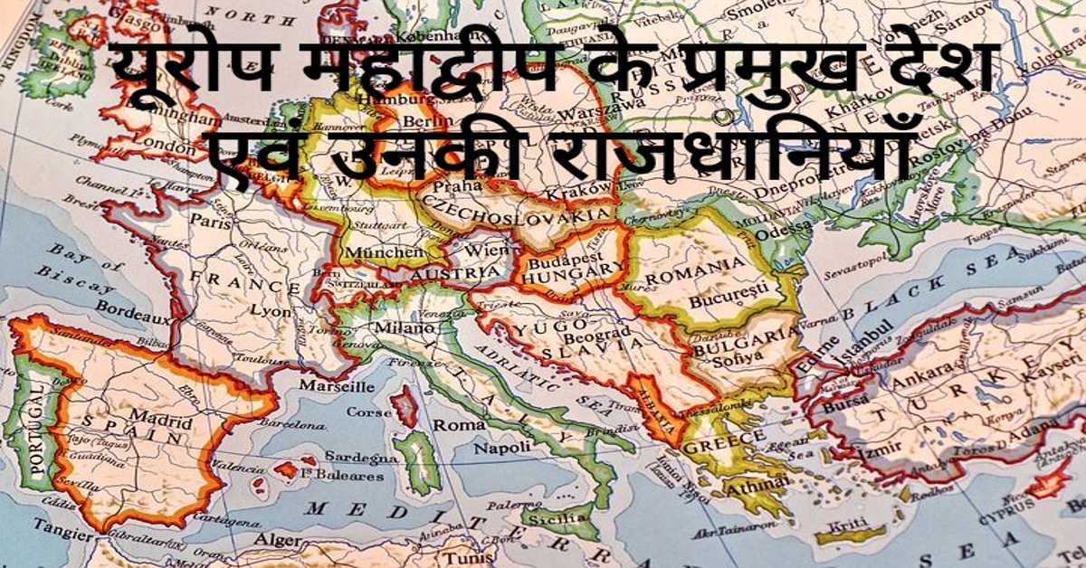
यूरोप महाद्वीप के प्रमुख देश एवं उनकी राजधानियाँ | Europe's Main Countries And Their Capitals
यहाँ यूरोप महाद्वीप के प्रमुख देश एवं उनकी राजधानियाँ दी गई हैं। Europe's Main Countries And Their Capitals given here.
Read more
जर्मनी (यूरोप) की भौगोलिक एवं राजनीतिक विशेषताएँ | Geographical And Political Features Of Germany (Europe)
जर्मनी यूरोप महाद्वीप के महत्वपूर्ण देशों में से एक है। इसके उत्तर-पश्चिम में उत्तर सागर स्थित है। जर्मनी के उत्तर-पूर्व में बाल्टिक सागर स्थित है।
Read more.jpg)
फ्रांस (यूरोप) की भौगोलिक एवं राजनीतिक विशेषताएँ | Geographical And Political Features Of France (Europe)
फ्रांस क्षेत्रफल की दृष्टि से यूरोप महाद्वीप का दूसरा सबसे बड़ा देश है। यूरोप महाद्वीप का सबसे बड़ा देश रूस है।
Read more