
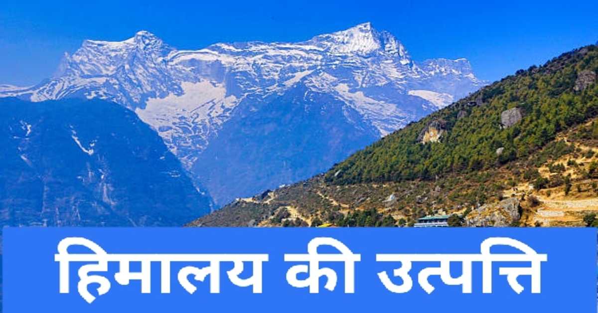


हिमालय पर्वत की उत्पत्ति- भू-सन्नति एवं विवर्तनिकी का सिद्धांत | Origin of Himalaya Mountains, Theory of Geo-convection and Tectonics
हिमालय पर्वत एक जटिल पर्वत तंत्र है। हिमालय उत्पत्ति के प्रमुख सिद्धांत निम्नलिखित हैं- 1. भू-सन्नति का सिद्धांत 2. प्लेट विवर्तनिकी
भारतीय हिमालय पाकिस्तान की पूर्वी सीमा से लेकर म्यांमार की सीमा तक विस्तृत है। इसकी लंबाई लगभग 2500 किलोमीटर है। इसकी चौड़ाई पूर्व में लगभग 320 किलोमीटर तथा पश्चिम भाग में लगभग 500 किलोमीटर है। भौगोलिक दृष्टि से हिमालय पर्वत भारत के गंगा-ब्रह्मपुत्र मैदान के उत्तर में स्थित है। हिमालय पर्वत और उत्तरी भारत के मैदान 'हिमालय फ्रंट फॉल्ट' द्वारा एक दूसरे से अलग होते हैं। भारत के हिमालय प्रदेश में जम्मू-कश्मीर, उत्तराखंड, हिमाचल प्रदेश, अरुणाचल प्रदेश तथा सिक्किम शामिल हैं। इन प्रदेशों के अलावा हिमालय भारत की सीमा से बाहर नेपाल एवं भूटान देशों में भी विस्तृत है। भारतीय हिमालय की एक भुजा उत्तर में अरुणाचल प्रदेश से दक्षिण की ओर नागालैंड, मणिपुर तथा मिजोरम होते हुए भारत और म्यांमार की सीमा निर्धारित करती है।
The Indian Himalayas extend from the eastern border of Pakistan to the border of Myanmar. Its length is about 2500 km. Its width is about 320 km in the east and about 500 km in the west. Geographically, the Himalaya Mountains are located to the north of the Ganges-Brahmaputra plain of India. The Himalayan Mountains and the plains of northern India are separated from each other by the 'Himalayan Front Fault'. The Himalayan region of India includes Jammu and Kashmir, Uttarakhand, Himachal Pradesh, Arunachal Pradesh and Sikkim. Apart from these regions, the Himalayas extend beyond the borders of India into the countries of Nepal and Bhutan. An arm of the Indian Himalayas, from Arunachal Pradesh in the north to Nagaland, Manipur and Mizoram in the south, forms the boundary between India and Myanmar.
ब्रह्माण्ड एवं खगोल विज्ञान के इन 👇 प्रकरणों के बारे में भी जानें।
1. ब्रह्माण्ड की उत्पत्ति
2. खगोलीय पिण्ड
3. तारों का जन्म एवं मृत्यु
4. सौरमंडल की संरचना
5. सौरमंडल के पिण्ड
6. सौर मंडल के ग्रह एवं उपग्रह की विशेषताएँ
हिमालय पर्वत एक जटिल पर्वत तंत्र है। इसकी उत्पत्ति को लेकर भूगर्भशास्त्रों तथा भू-आकृति विज्ञान के विशेषज्ञों में विवाद रहा है। हिमालय पर्वत में प्री-केम्ब्रियन युग से लेकर इयोसीन युग तक की समस्त चट्टाने पाई जाती हैं। इनमें से अधिकांश चट्टानें परतदार और परिवर्तित होती हैं। इन चट्टानों में वलन और भ्रंश भी पाए जाते हैं। हिमालय उत्पत्ति के प्रमुख सिद्धांत निम्नलिखित हैं-
1. भू-सन्नति का सिद्धांत
2. प्लेट विवर्तनिकी
The Himalaya Mountains are a complex mountain system. There has been a dispute between the experts of geology and geomorphology regarding its origin. All the rocks from the Pre-Cambrian era to the Eocene age are found in the Himalayan Mountains. Most of these rocks are flaky and metamorphic. Folds and faults are also found in these rocks. Following are the main theories of Himalaya origin-
1. Theory of Geo-prosperity
2. Plate Tectonics
हिमालय की उत्पत्ति का भूसन्नति का सिद्धांत- इस सिद्धांत के प्रमुख समर्थक प्रोफ़ेसर अरगांड, सुवेस तथा कोबर हैं। इस सिद्धांत के अनुसार आज से लगभग 20 करोड़ वर्ष पहले, पेंजिया का विखंडन शुरू हुआ था। इस घटना के कारण टेथिस सागर उत्पन्न हुआ। इस नये सागर के उत्तर में लॉरेंशिया शील्ड या अंगारालैंड एवं दक्षिण में गोंडवानालैंड का निर्माण हुआ। वर्तमान से लगभग 18 करोड़ वर्ष पहले मैसोजोइक कल्प में वर्तमान हिमालय की जगह टेथिस सागर स्थित था। भूगर्भशास्त्रियों के अनुसार पैलियोजोईक कल्प के अंत तथा मैसोज़ोइक कल्प के प्रारंभ में टेथिस सागर का विस्तार अधिकतम था। तत्कालीन समय में यह पश्चिम में अटलांटिक महासागर और यूरोप से लेकर पूर्व में प्रशांत महासागर और चीन तक विस्तृत था। यह लगभग पूरी पृथ्वी को फैला हुआ था। कालांतर में अंगारालैंड तथा गोंडवानालैंड के भू-भाग से अवसादों का अपरदन होने लगा। इससे अवसाद बहकर टेथिस सागर में जमा होने लगे। इन अवसादों का भार अधिक होने के कारण इस सागर की तलहटी नीचे की ओर धरती गई एवं अवसादों और निक्षेपों की मोटाई बढ़ती गई। फलस्वरूप क्रिटेशियस युग में टेथिस सागर के अवसादों में उत्थान शुरू हुआ तथा एक क्रम से दीर्घ हिमालय, लघु हिमालय व शिवालिक पर्वतमालाएँ उत्पन्न हुईं। इस सिद्धांत के अनुसार आज से लगभग 65 मिलियन वर्ष पहले इयोसीन कल्प में दीर्घ हिमालय का उत्थान हुआ था। आगे चलकर 45 मिलियन वर्ष पहले मायोसिन कल्प में लघु हिमालय का उत्थान हुआ। इसके बाद लगभग 1.4 मिलियन वर्ष पहले प्लायोसीन कल्प में शिवालिक या बाह्य हिमालय का उत्थान हुआ।
पृथ्वी की संरचना एवं इस पर होने वाली हलचलों से संबंधित इन 👇 प्रकरणों के बारे में भी जानें।
1. पृथ्वी की संरचना
2. पृथ्वी की गतियाँ
3. अक्षांश एवं देशांतर रेखाएँ
4. भूकंप एवं भूकम्पीय तरंगे
5. सुनामी और ज्वालामुखी क्या है
6. पृथ्वी पर ज्वार भाटा
7. ग्रहण, ऋतु परिवर्तन विषुव एवं सुपरमून
Theory of the Origin of the Himalayas- The main proponents of this theory are Professors Argand, Suaves and Kobar are. According to this theory, about 200 million years ago, the fragmentation of Pangea began. This event led to the creation of the Tethys Sea. In the north of this new ocean, Laurentia Shield or Angaraland and in the south Gondwanaland was formed. In the Mesozoic era, about 180 million years before the present, the Tethys Sea was located in place of the present Himalayas. According to geologists, the extent of the Tethys Sea was maximum at the end of the Paleozoic era and the beginning of the Mesozoic era. At that time it extended from the Atlantic Ocean and Europe in the west to the Pacific Ocean and China in the east. It spanned almost the entire earth. Later on, the sediments started being eroded from the land of Angaraland and Gondwanaland. Due to this the depression started flowing and accumulating in the Tethys Sea. Due to the high weight of these sediments, the bottom of this ocean went down to the earth and the thickness of the sediments and deposits increased. As a result, the Tethys Sea sediments began to rise in the Cretaceous era and a sequence of Major Himalayas, Lesser Himalayas and Shivalik ranges arose. According to this theory, about 65 million years ago, the great Himalayas were uplifted in the Eocene epoch. Later in the Miocene epoch, 45 million years ago, the rise of the Lesser Himalayas took place. This was followed by the rise of the Shivaliks or outer Himalayas in the Pliocene epoch, about 1.4 million years ago.
प्लेट विवर्तनिकी का सिद्धांत एवं हिमालय की उत्पत्ति- इस सिद्धांत को सन् 1967 में प्रिंस्टन यूनिवर्सिटी के प्रोफेसर डब्ल्यू. जे. मॉर्गन ने दिया था। यह सिद्धांत समुद्र तल विस्तारण की अवधारणा पर आधारित है। इस अवधारणा को एच. एच. हैस ने दिया था। इस सिद्धांत के अनुसार आज से लगभग 65 मिलियन वर्ष पहले वर्तमान हिमालय के स्थान पर टेथिस सागर विस्तृत था। यह सागर भारी भू-सन्नति के रूप में विस्तृत था। तब टेथिस सागर की भू-सन्नति में पार्श्विक संपीड़न शुरू हुए। इसके फलस्वरूप टेथिस सागर में निक्षेपित अवसादों में संकुचन व वलन की प्रक्रिया शुरू हुई। इसके परिणामस्वरूप अंत में हिमालय पर्वत की तीन समांतर श्रेणीयों का उत्थान हुआ। भूगर्भशास्त्रियों के अनुसार अभितरण की प्रक्रिया के फलस्वरुप हिमालय प्रदेश में लगभग 500 किलोमीटर के भू-पटल में सिकुड़न आने लगी। इसकी भरपाई हिंद महासागर प्रदेश में समुद्री कटकों के विस्तार के रूप में हुई। वर्तमान में भारतीय प्लेट उत्तर में हिमालय की ओर संचालित हो रही है। परिणाम स्वरूप आज भी हिमालय पर्वत के शिखरों का उत्थान हो रहा है।
ऋतुओं एवं जलवायु से संबंधित इन 👇 प्रकरणों के बारे में भी जानें।
1. भारत की प्रमुख ऋतुएँ
2. भारत की जलवायु का वर्गीकरण
3. मानसून- भारत की जलवायु
4. 5. वर्षा के प्रकार संवहनीय, पर्वतीय, चक्रवाती वर्षा
5. संघनन क्या है- संघनन के विभिन्न रूप
Theory of Plate Tectonics and the Origin of the Himalayas- This theory was proposed in 1967 by Professor W. J. Morgan of Princeton University. This theory is based on the concept of sea level expansion. This concept was introduced by H. H. Hayes. According to this theory, about 65 million years ago, the Tethys Sea expanded in place of the present Himalayas. This ocean was wide in the form of heavy land consolidation. Then the lateral compression in the ground depression of the Tethys Sea began. As a result, the process of contraction and folding started in the sediments deposited in the Tethys Sea. This eventually resulted in the rise of three parallel ranges of the Himalayan Mountains. According to geologists, as a result of the process of subduction, there was a shrinkage in the earth's surface of about 500 km in the Himalayan region. This was compensated by the expansion of sea ridges in the Indian Ocean region. Presently the Indian plate is moving north towards the Himalayas. As a result, the peaks of the Himalaya Mountains are still rising.
अतः स्पष्ट है कि आज से लगभग 65 मिलियन वर्ष पूर्व भारतीय और एशियाई प्लेटों के निकट आने के कारण संघात उत्पन्न हुआ था। इसके फलस्वरूप हिमालय पर्वत की उत्पत्ति हुई थी। इसके उत्थान का प्रथम चरण वर्तमान से लगभग 65 मिलियन वर्ष पहले प्रारंभ हुआ था। इस चरण में ग्रेनाइट ऊपर की ओर उठने लगा। भूगर्भशास्त्रियों के अनुसार हिमालय उत्थान के प्रथम चरण की शुरुआत में लद्दाख व जास्कर पर्वत उत्पन्न हुए। ये पर्वत दीर्घ हिमालय के पार स्थित हैं। इनकी उत्पत्ति टेथिस सागर के अवसदों के उत्थान से हुई थी। हिमालय की उत्पत्ति प्रमुख रूप से टेथिस सागर में जमा हुए निक्षेपों तथा अवसादों के ऊपर उठने से हुई थी। भारतीय अधिक्षेपण के टेथिस सागर की तलहटी नीचे की ओर धँसती गई। इससे भारतीय प्लेट के उत्तर की ओर खिसकने लगी। इससे दीर्घ हिमालय की उत्पत्ति हुई। इस प्रक्रिया में तिब्बत के पठार की महत्वपूर्ण भूमिका रही थी। तिब्बत का पठार कठोर, दृढ़ एवं विशाल है। दृढ़ तिब्बत पिंड के उत्पन्न होने से टेथिस सागर के निक्षेप में उत्थान होने लगा। इस प्रक्रिया के परिणामस्वरुप अल्ट्राबेसिक चट्टानों का हिमालय पर्वत में उत्थान हुआ। इन चट्टानों को ओफियोलाइटस भी कहा जाता है। इन चट्टानों को लद्दाख व जास्कर पर्वतमालाओं में देखा जा सकता है। दीर्घ हिमालय के उत्पन्न होने से हिमालय व जास्कर तथा लद्दाख श्रेणियों में एक सीवन का निर्माण हो गया। इसे सिंधु सीवन कहा जाता है।
भारत की प्रमुख नदियों के अपवाह तंत्र से संबंधित इन 👇 प्रकरणों के बारे में भी जानें।
1. सिंधु नदी का अपवाह तंत्र
2. गंगा नदी का अपवाह तंत्र
3. हिमालय की प्रमुख नदियों से संबंधित परियोजनाएँ
4. प्रायद्वीपीय भारत की प्रमुख नदियों का अपवाह तंत्र
5. भारत की प्रमुख झीलें
So it is clear that the impact was caused by the coming of the Indian and Asian plates about 65 million years ago. As a result, the Himalaya Mountains were formed. The first phase of its rise began about 65 million years before the present. In this phase the granite began to rise upwards. According to geologists, Ladakh and Zaskar Mountains arose at the beginning of the first phase of Himalayan uplift. These mountains are situated across the great Himalayas. They originated from the uplift of the Tethys Sea depressions. The origin of the Himalayas was mainly due to the uplift of deposits and sediments in the Tethys Sea. The foothills of the Tethys Sea of the Indian subsidence sank downwards. This led to the northward movement of the Indian plate. This gave rise to the Great Himalayas. The Tibetan Plateau had an important role in this process. The plateau of Tibet is hard, firm and vast. With the emergence of the solid Tibet mass, the Tethys Sea deposits began to rise. This process resulted in the uplift of ultrabasic rocks in the Himalayan Mountains. These rocks are also called ophiolites. These rocks can be seen in the Ladakh and Zaskar ranges. With the emergence of the Greater Himalayas, a seam was formed between the Himalayas and the Zaskar and Ladakh ranges. It is called Sindhu Sivan.
हिमालय पर्वत के उत्थान का दूसरा प्रमुख चरण आज से लगभग 45 मिलियन वर्ष पहले प्रारंभ हुआ। इसके परिणामस्वरूप लघु हिमालय की उत्पत्ति हुई। इस कल्प में तीव्र व मन्द ढलान वाली पर्वत श्रंखलाओं की उत्पत्ति हुई। इसके अंतर्गत धौलाधार, पीर-पंजाल, महाभारत श्रेणियाँ, करोल शामिल हैं। दीर्घ हिमालय एवं लघु हिमालय को मेन सेंट्रल थ्रस्ट या भ्रंश एक-दूसरे से अलग करता है। लघु हिमालय के पर्वत-स्कंधों की उत्पत्ति से विभिन्न पर्वतों से घिरे बेसिनों का निर्माण हुआ। ऐसे प्रमुख बेसिन करोल-बेसिन, कश्मीर-घाटी, दून-वैली, नेपाल की काठमांडू घाटी हैं। इसी अवधि में निर्मित अग्रगर्त में निक्षेप तथा अवसाद लगातार जमा होते गए। इन्हीं निक्षेपों के कारण शिवालिक या बाह्य हिमालय की उत्पत्ति हुई। शिवालिक पर्वत का उत्थान मायोसीन और प्लास्टोसीन कल्प के बीच हुआ था। इसकी अवधि 1.4 मिलीयन वर्ष पहले की है। लघु हिमालय और शिवालिक मेन बाऊंड्री थ्रस्ट या भ्रंश द्वारा अलग होते हैं। शिवालिक पर्वत में पर्तदार चट्टानों की मोटाई लगभग 5000 मीटर है। शिवालिक पर्वत में बोल्डर तथा कांगलामिरेट की मोटी परतें होती हैं। शिवालिक पर्वत को हिमालयन फ्रंट फाल्ट अर्थात् भ्रंश उत्तरी भारत के मैदान से अलग करता है।
भौगोलिक जानकारी से संबंधित इन 👇 प्रकरणों के बारे में भी जानें।
1. पृथ्वी की स्थलाकृतियाँ
2. मृदा- एक सामान्य परिचय
3. मृदा अपरदन के कारण एवं बचाव के उपाय
4. 8 जनवरी- 'पृथ्वी घूर्णन दिवस' सामान्य ज्ञान
5. विश्व की प्रमुख जल संधियाँ
6. विश्व की प्रमुख जल संधियाँ मुख्य बिन्दु सहित
The second major phase of the uplift of the Himalayan Mountains started about 45 million years ago from today. This resulted in the formation of the Lesser Himalayas. In this kalpa, mountain ranges with steep and slow slopes were born. It includes Dhauladhar, Pir-Panjal, Mahabharata Ranges, Karol. The Main Central Thrust separates the Greater Himalayas and the Lesser Himalayas from each other. The origin of the mountain-volumes of the Lesser Himalayas led to the formation of basins surrounded by various mountains. Major such basins are Karol–Basin, Kashmir–Valley, Doon–Valley, Kathmandu Valley of Nepal. Deposits and depressions continued to accumulate in the fore formed during this period. Due to these deposits Shivalik or outer Himalaya originated. The uplift of the Shivalik Mountains took place between the Miocene and Pleistocene epochs. Its period dates back to 1.4 million years ago. The Lesser Himalayas and the Shivaliks are separated by the Main Boundary Thrust or fault. The thickness of the lithic rocks in the Shivalik Mountains is about 5000 meters. The Shivalik mountain consists of thick layers of boulders and conglomerate. The Himalayan Front Fault separates the Shivalik Mountains from the plain of northern India.
हिमालय की शिवालिक पर्वतमाला में सम्मिलित वलन पाए जाते हैं। शिवालिक के सम्मिलित वलन फ्रांस तथा स्विट्जरलैंड की सीमा पर स्थित जूरा पर्वत से मिलते-जुलते हैं। वर्तमान में हिमालय फ्रंट फाल्ट बहुत सक्रिय हैं। इससे उत्तरी भारत के मैदान, शिवालिक और लघु तथा हिमालय में भूकंप की बारंबारता बढ़ी हुई है।
Involved folds are found in the Shivalik ranges of the Himalayas. The combined folds of Shivalik are similar to the Jura mountain located on the border of France and Switzerland. Presently the Himalayan Front Faults are very active. This has increased the frequency of earthquakes in the plains of northern India, the Shivaliks and the Lesser and the Himalayas.
विभिन्न संसाधनों से संबंधित इन 👇 प्रकरणों के बारे में भी जानें।
1. भारत में जल संसाधन
2. भारत में जल परियोजनाएँ
3. ऊर्जा के पारंपरिक और गैर-पारंपरिक स्रोत
4. भारत के भूआकृतिक प्रदेश
5. भारत में हिमालय पर्वत का महत्व
आशा है, उपरोक्त जानकारी परीक्षार्थियों / विद्यार्थियों के लिए ज्ञानवर्धक एवं परीक्षापयोगी होगी।
धन्यवाद।
RF Temre
infosrf.com
संबंधित जानकारी नीचे देखें।
(Watch related information below) 👇🏻

आशा है, उपरोक्त जानकारी उपयोगी एवं महत्वपूर्ण होगी।
(I hope the above information will be useful and important. )
Thank you.
लेखक
(Writer)
infosrf.com
पाठकों की टिप्पणियाॅं (0)
You may also like
यूरोप महाद्वीप के प्रमुख देश एवं उनकी राजधानियाँ | Europe's Main Countries And Their Capitals
यहाँ यूरोप महाद्वीप के प्रमुख देश एवं उनकी राजधानियाँ दी गई हैं। Europe's Main Countries And Their Capitals given here.
Read more
जर्मनी (यूरोप) की भौगोलिक एवं राजनीतिक विशेषताएँ | Geographical And Political Features Of Germany (Europe)
जर्मनी यूरोप महाद्वीप के महत्वपूर्ण देशों में से एक है। इसके उत्तर-पश्चिम में उत्तर सागर स्थित है। जर्मनी के उत्तर-पूर्व में बाल्टिक सागर स्थित है।
Read more.jpg)
फ्रांस (यूरोप) की भौगोलिक एवं राजनीतिक विशेषताएँ | Geographical And Political Features Of France (Europe)
फ्रांस क्षेत्रफल की दृष्टि से यूरोप महाद्वीप का दूसरा सबसे बड़ा देश है। यूरोप महाद्वीप का सबसे बड़ा देश रूस है।
Read more